Mostly Cloudy Skies and Scattered Storms Expected to Continue Across Jacksonville Area
JACKSONVILLE, Fla. — Residents across Jacksonville should prepare for more unsettled weather this week, with forecasters predicting continued cloudy skies, scattered storms, and muggy conditions through at least midweek.
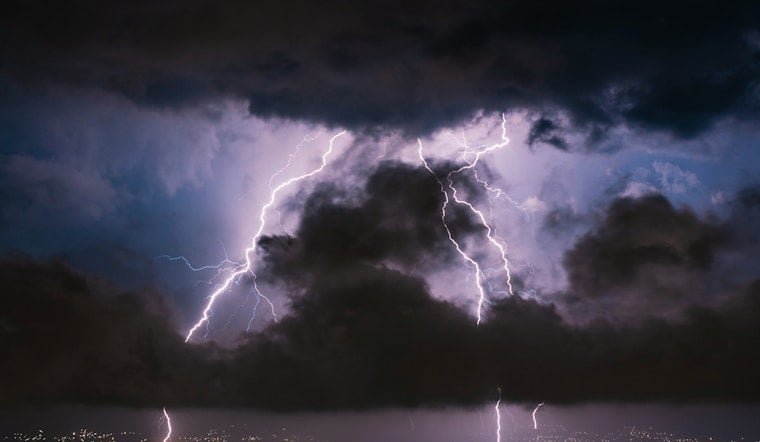
Storms Roll In With Tropical Moisture
The Tuesday evening weather brought heavy downpours, gusty winds, and lightning, helping briefly cool the region but also setting the stage for more rain to come. According to News4JAX, overnight storms are expected to contribute to additional rainfall as unstable tropical air continues to flow in from a low-pressure system over the Gulf.
Wednesday Forecast: Hot, Humid, and Stormy
Wednesday’s highs are forecast to remain in the low 90s, but humidity will push the “feels like” temperatures into the 100–104°F range. Scattered thunderstorms are anticipated to begin after lunchtime and may last through sunset.
Unsettled Weather Pattern Continues
Looking ahead, meteorologists are calling for a hot and humid week, with daily chances of thunderstorms. While highs will generally stay in the upper 80s to 90s, persistent humidity will continue to make conditions feel warmer.
“Afternoon storm activity will remain a regular feature,” forecasters noted, “as tropical moisture and daytime heating combine across the area.”
Localized Flooding Possible
With daily storm chances and already saturated ground in some parts of the Jacksonville metro, localized flooding may occur in low-lying areas. Drivers are encouraged to use caution during heavy rainfall and avoid flooded roadways.
Get Involved: Share Your Weather Photos
Residents are invited to share storm photos and videos with local weather teams through platforms like SnapJAX, which collects community-submitted visuals to help track local weather conditions.
What’s Next: Keep checking the latest local forecasts throughout the week for potential updates on flood advisories and heat alerts. This weather pattern, driven by a Gulf low-pressure system, may remain active into next week.
Are you experiencing flooding or extreme heat in your neighborhood? Stay safe and let us know what you’re seeing by sharing your observations and photos at SaludaStandard-Sentinel.com.