Damaging Winds Heavy Rain and Strong Tornado Threat Strikes Kentucky Illinois Missouri and Indiana With Severe Storm Line Moving Through Monday Evening Into Overnight
KENTUCKY — A organized and fast-moving line of severe storms pushed through western Kentucky, Illinois, Missouri, and Indiana on the evening of April 27, 2026, bringing damaging wind potential, heavy rain, frequent lightning, and a threat for more organized storm development across the region during the Monday evening into overnight hours.
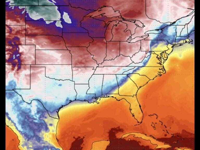
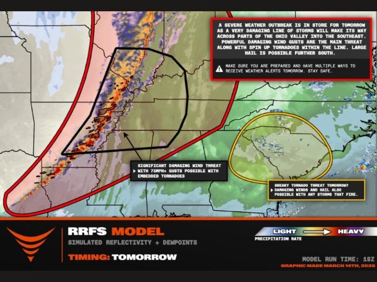
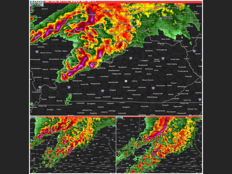
Radar imagery captured across multiple time frames showed intense reflectivity returns concentrated through western and central Kentucky, with the most significant storm energy displaying deep magenta and red signatures consistent with heavy precipitation and strong rotation embedded within the squall line.
Western States Take the First and Hardest Hit
The storm system ramped up significantly across western Kentucky, Illinois, Missouri, and Indiana during the 7 to 9 PM window on Monday evening. This western corridor faced the greatest concentration of severe hazards including strong to severe storm intensity, damaging wind potential, heavy rainfall, frequent lightning, and a more favorable setup for organized storm development compared to areas further east.
The atmospheric dynamics driving the system produced a well-defined and expansive line of storms visible across radar, stretching from southern Illinois through Indiana and into the Louisville and surrounding Kentucky metro areas.
Central Kentucky Faces Storm Arrival Between 9 and 11 PM
As the storm line pushed eastward through the late evening hours between 9 and 11 PM, central Kentucky moved into the direct impact window. Western Kentucky was already contending with the system during this period while central portions of the state braced for incoming storm activity.
Storm lines of this nature typically lose some intensity as they advance eastward, though damaging winds and heavy rainfall remained possible threats for communities across central Kentucky even as the system progressed through the region.
Overnight Hours Bring Gradual Easing but Continued Hazards
Through midnight and into the early morning hours, the storm system continued sliding eastward across Kentucky. Gusty winds and heavy rainfall remained possible well into the overnight period, though the overall severe threat was expected to gradually ease as the line moved further east and the most unstable atmospheric energy shifted away from the region.
Radar progression across the three captured time frames showed the storm complex maintaining significant organization through Indiana and Kentucky before beginning its eastward push toward the Ohio Valley.
Residents Urged to Stay Weather Aware Through the Night
The worst of the severe weather setup remained concentrated west of central Kentucky, though locally strong storms presented a continued monitoring concern through the overnight hours. Residents across the warned corridor were advised to keep mobile devices charged, weather alert notifications active, and shelter plans ready as timing favored the evening into overnight window for the most significant storm impacts.
For continuing coverage of severe weather events and critical storm analysis across the United States, visit SaludaStandard-Sentinel.com.