Massive HP Supercell With Multiple Rotation Areas and Possible Brief Tornado Tracked From Trenton to Brookfield Missouri as Dangerous MCS Complex Follows Overnight
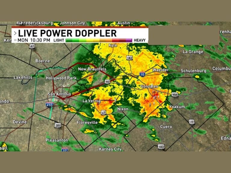
TRENTON, MO — A massive high precipitation supercell was tracked from Trenton, Missouri southward toward Brookfield, producing multiple stout areas of rotation that repeatedly attempted to establish a tornado touchdown during its lifespan across north-central Missouri. The storm, characterized as a large HP blob supercell, displayed intense and persistent rotation throughout its tracked duration, with a brief weak tornado considered possible pending further video review and any damage surveys conducted across the affected corridor.
Massive HP Supercell Produces Multiple Rotation Areas Across North Central Missouri
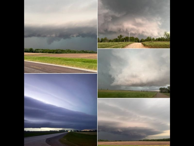
The high precipitation supercell tracked from Trenton toward Brookfield exhibited multiple distinct and stout areas of rotation that aggressively attempted to plant tornadoes across the north-central Missouri landscape throughout the chase. The storm’s HP characteristics, meaning it was wrapped in heavy precipitation, made visual observation of any potential tornado circulation particularly challenging as the storm moved through the region during the evening hours.
Photographic documentation from the storm chase shows an impressively structured and visually dramatic supercell with well defined inflow, shelf cloud features, and turbulent storm base characteristics consistent with a highly organized and dangerous rotating thunderstorm capable of significant tornado production under the right conditions.
Brief Weak Tornado Possible Pending Video Review and Damage Surveys
While no tornado was confirmed with certainty during the storm chase documentation, a brief weak tornado is considered possible based on the observed rotation intensity and the storm’s repeated attempts to establish a ground contact circulation near Brookfield. Final determination of whether a tornado occurred will depend on subsequent review of video footage captured during the chase and any official damage surveys conducted by meteorological authorities across the areas beneath the storm’s most intense rotation zones.
Half dollar sized hail was encountered multiple times while passing through the storm’s hail cores during the chase, representing the largest hail documented with this particular supercell despite the storm’s impressive size and rotational characteristics throughout its tracked lifespan.
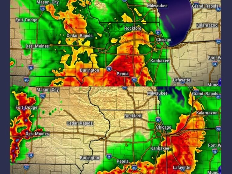
Impressive MCS Complex Develops Overnight Extending the Severe Weather Event
Following the supercell phase of the evening, an impressive and expansive mesoscale convective system complex developed across the region, adding another layer of severe weather hazard to an already active night across Missouri and surrounding states. The MCS complex presented a visually striking appearance as it spread across the landscape during the overnight hours, reflecting the continued atmospheric instability and moisture supporting organized convection well beyond the initial supercell storm mode of the evening.
With Monday forecast to bring another significant severe weather setup across the broader region, the severe weather pattern across the Central Plains and Midwest shows no signs of relenting in the immediate days ahead.
For continuing coverage of severe weather events and storm tracking across the United States, visit SaludaStandard-Sentinel.com.