Strong to Severe Thunderstorm Line With Damaging Winds Hail and Tornado Possible to Strike Gulf Coast Region by 8 AM Tomorrow With Little Warning Time for Residents
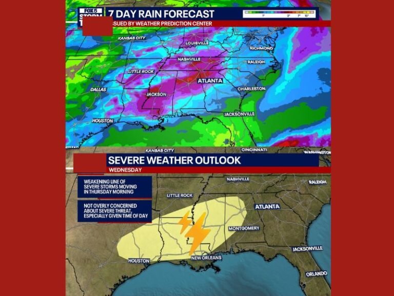
GULF COAST REGION — A line of strong to severe thunderstorms is forecast to push through the Gulf Coast region by 8 AM tomorrow morning, carrying threats of damaging straight-line winds, hail, and the possibility of a quick spin-up tornado embedded within the fast-moving line, with forecasters warning that some storms may roll through rapidly and with very little advance warning time for residents across the affected corridor.
Severe Thunderstorm Line Expected by Early Morning
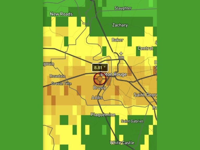
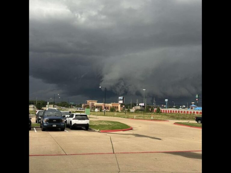
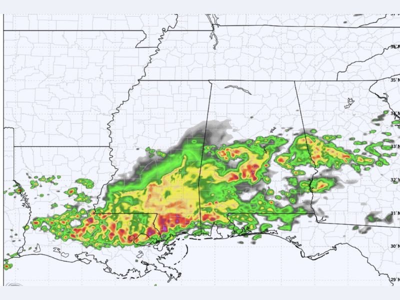
Radar imagery shows an expansive and intense storm system already producing heavy precipitation across Louisiana, Mississippi, and Alabama, with the most extreme returns concentrated along and near the Gulf Coast. The storm line is expected to push through the region during the early morning hours, meaning residents across coastal communities could face the most dangerous conditions before fully beginning their morning routines.
The fast-moving nature of the line is among the most concerning aspects of this particular event, as quickly advancing storm systems compress the available warning time between initial alert issuance and actual storm arrival to a minimum.
Damaging Winds and Hail Among Primary Threats
The primary threats associated with tomorrow morning’s storm line include damaging straight-line winds capable of downing trees, snapping utility lines, and causing structural damage across communities in the direct path of the system. Hail is also expected with the stronger cells embedded within the line, posing a direct threat to vehicles, roofing materials, and any outdoor property left unsecured overnight ahead of the storm’s arrival along the Gulf Coast.
Both threats can materialize rapidly as the line pushes through, leaving minimal time for residents to respond once storms enter their immediate area during the early morning hours.
Quick Spin-Up Tornado Cannot Be Ruled Out
Forecasters note that a quick spin-up tornado embedded within the storm line cannot be ruled out as the system pushes through the Gulf Coast corridor tomorrow morning. Tornadoes associated with fast-moving line systems differ from classic supercell tornadoes in that they typically form and dissipate extremely rapidly, often with very little radar lead time and no visible funnel cloud due to the rain-wrapped nature of line-embedded circulations.
This characteristic makes early warning system awareness especially critical for all Gulf Coast residents ahead of the 8 AM storm window.
Residents Urged to Have Alerts Active Before Bed
Given the early morning timing of the threat, Gulf Coast residents are strongly urged to ensure all weather alert systems and smartphone emergency notifications are fully active before going to sleep tonight. Relying solely on outdoor sirens or social media updates during a fast-moving early morning severe weather event significantly increases personal risk across the affected region.
For continuing coverage of severe weather events and critical storm analysis across the United States, visit SaludaStandard-Sentinel.com.