Flood Warnings Issued for Paris and Clarksville Texas as Training Rains Along Stalled Red River Boundary Drop 2 to 4 More Inches With Triple Digit Heat Approaching
PARIS, TX — Flood warnings are in effect for Paris and Clarksville in far Northeast Texas as training rains continue falling along a stalled frontal boundary draped across the Red River, with an additional 2 to 4 inches of rainfall possible in the warned area, even as a building ridge of high pressure sets the stage for triple digit heat across the rest of North Texas in the days ahead.
Training Rains Hammer Northeast Texas Along Stalled Boundary
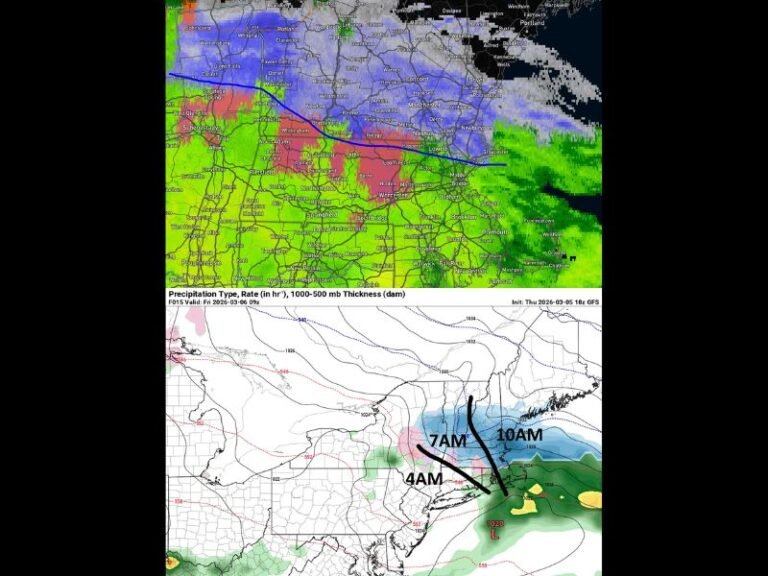
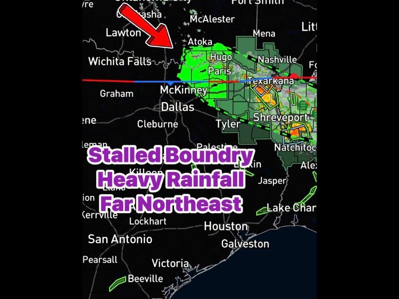
A northwest flow pattern combined with a stalled frontal boundary has set up a training rain scenario across far Northeast Texas, with repeated rounds of heavy rainfall moving over the same communities near Paris, Clarksville, and the surrounding Red River counties. This training setup dramatically increases flood potential, as the same areas continue receiving rainfall rather than any single storm system moving through and clearing the region.
Radar imagery showed a concentrated area of heavy rainfall between Hugo and Paris, with active flood warnings already in place for the most heavily impacted communities. The stalled boundary showed little sign of lifting or shifting, suggesting the heavy rain threat could persist for an extended period.
Flood Warnings Active for Paris and Clarksville
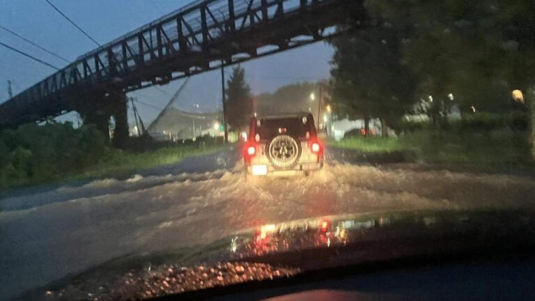
Active flood warnings were issued covering Paris and Clarksville, with forecasters warning that an additional 2 to 4 inches of rainfall remains possible on top of what has already fallen across the area. Residents in and around these communities were urged to avoid flooded roadways and low-lying areas as the repeated rainfall rounds continue to saturate soils and raise water levels on area streams and waterways.
The remainder of North Texas, including Dallas, McKinney, and Wichita Falls, remains under a building ridge of high pressure that is limiting storm coverage across most of the region, with only a 20 percent chance of an isolated shower or downpour through the afternoon.
Triple Digit Heat Returns After Thursday
Once the slight rain chance fades after Thursday, the pattern shifts decisively toward dangerous summer heat as the high pressure ridge fully takes over. Triple digit temperatures are expected to return to North Texas in the days following Thursday as true summer heat arrives and dominates the regional forecast through the extended period.
For continuing coverage of flood warnings and heat events across the United States, visit SaludaStandard-Sentinel.com.