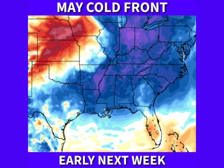
Stalling Cold Front to Trigger Heavy Rain and Prolonged Storms Across Texas From Dallas and Houston Through San Antonio Starting Sunday Night and Continuing Through Most of Next Week
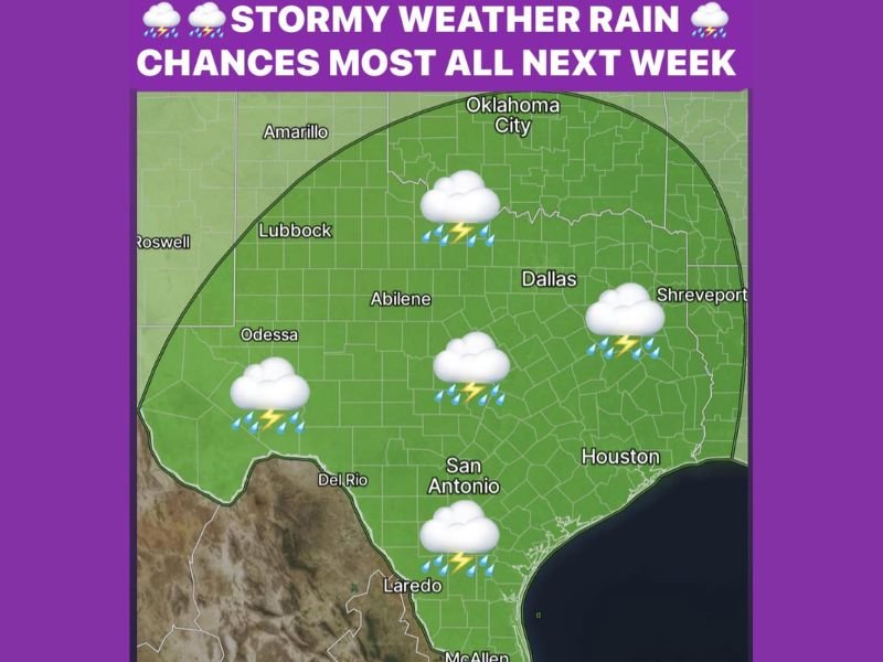
DALLAS, TX — A wet and stormy week is taking shape across Texas beginning Sunday night and continuing through most of next week, as a slow-moving cold front pushes into the state bringing heavy rain Monday and Tuesday before stalling and generating prolonged rounds of rain and thunderstorms across a broad corridor covering Dallas, San Antonio, Houston, and communities statewide through the heart of May, which historically ranks as the wettest month of the year across North Texas.
Daily Rain Chances Begin Sunday Night
The active weather pattern kicks off Sunday night as daily rain chances and stormy conditions begin developing across the Texas region. The early phase of the wet week will be driven by the advancing cold front pushing southward into the state, with moisture and instability combining to support widespread shower and thunderstorm activity across the Dallas, Abilene, and surrounding North Texas communities as the week gets underway.
Residents across Texas should prepare for a significant shift from recent conditions as the sustained wet pattern establishes itself beginning Sunday evening.
Heavy Rain Monday and Tuesday as Front Pushes In
The most intense rainfall of the early week period arrives Monday and Tuesday as the cold front slowly advances deeper into Texas, delivering heavy rain to a broad swath of the state. The slow movement of the frontal boundary is a critical factor in the rainfall threat, as a slowly moving front allows precipitation to repeatedly impact the same geographic areas rather than moving through quickly and distributing rainfall more efficiently across a wider zone.
Communities from Dallas and Shreveport through Abilene, San Antonio, Laredo, and Houston all fall within the storm coverage zone expected to see the heaviest rainfall during the Monday and Tuesday timeframe.
Stalling Front Prolongs Storms Through Much of Next Week
By late Tuesday the front is forecast to stall across Texas, creating a prolonged period of additional rain and thunderstorm development along the stationary boundary through much of the remainder of next week. Stalling fronts represent one of the most significant flash flood threats in meteorology, as repeated rounds of heavy rainfall over the same areas can rapidly accumulate dangerous totals across the affected communities.
With May historically being the wettest month across North Texas, the combination of a stalling front and abundant Gulf moisture creates a setup capable of delivering significant weekly rainfall totals across the state.
For continuing coverage of severe weather events and critical storm analysis across the United States, visit SaludaStandard-Sentinel.com.