Severe Thunderstorm Warning With Tornado Possible Covers Abbeville and Anderson Counties South Carolina With 60 MPH Winds One Inch Hail and Torrential Rain Ongoing
ABBEVILLE, SC — An active Severe Thunderstorm Warning with a tornado possible designation is in effect across Abbeville and Anderson Counties in South Carolina, with radar indicated wind gusts of 60 miles per hour, one inch hail, and torrential rainfall ongoing across the warned zone. While storm rotation has weakened from its previous intensity, the storm remains severe and the possibility of a quick tornado spin-up redeveloping cannot be ruled out, keeping the tornado possible designation active within the broader severe thunderstorm warning for the affected counties.
Severe Thunderstorm Warning Active With Tornado Possible Across Abbeville and Anderson Counties
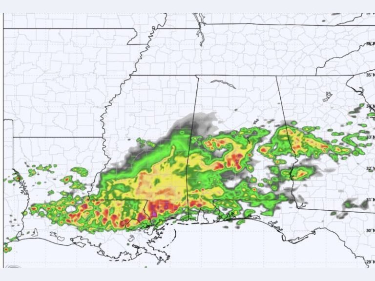
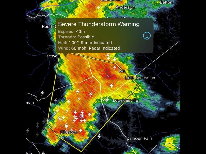
The active Severe Thunderstorm Warning covers a broad zone across Abbeville and Anderson Counties, with the yellow warning polygon visible on radar encompassing communities including Anderson, Iva, Lake Secession, Lowndesville, Hartwell, and Elberton as the intense storm complex moves through the region. The warning carries radar indicated parameters of 60 mph wind gusts and one inch hail alongside the tornado possible designation, reflecting the continued dangerous and multi-hazard character of this storm despite the weakening rotation trend.
Radar imagery shows intense red and orange reflectivity returns blanketing the warning polygon with frequent and widespread lightning activity visible throughout the warned zone, confirming the ongoing severe character of the storm complex across the Abbeville and Anderson County corridor.
Damaging Wind Torrential Rain and Frequent Lightning Remain Active Hazards
Even with the tornado threat reduced from its earlier peak, the combination of 60 mph wind gusts, torrential rainfall, and extremely frequent lightning creates a serious and multi-layered hazard for all residents within the warning zone. Damaging wind gusts at 60 miles per hour are capable of downing trees, snapping power lines, and causing structural damage across communities throughout Abbeville and Anderson Counties during the storm’s passage.
Quick Tornado Spin-Up Remains Possible as Residents Must Stay Sheltered
Despite the overall weakening of storm rotation, meteorologists are monitoring closely for the potential redevelopment of a quick tornado spin-up within the warning zone. This ongoing tornado possible designation means all residents across Abbeville and Anderson Counties must remain sheltered in the lowest interior room of a sturdy structure until the warning expires and conditions are officially declared safe by the National Weather Service.
For continuing coverage of severe thunderstorm warnings and tornado threats across the United States, visit SaludaStandard-Sentinel.com.