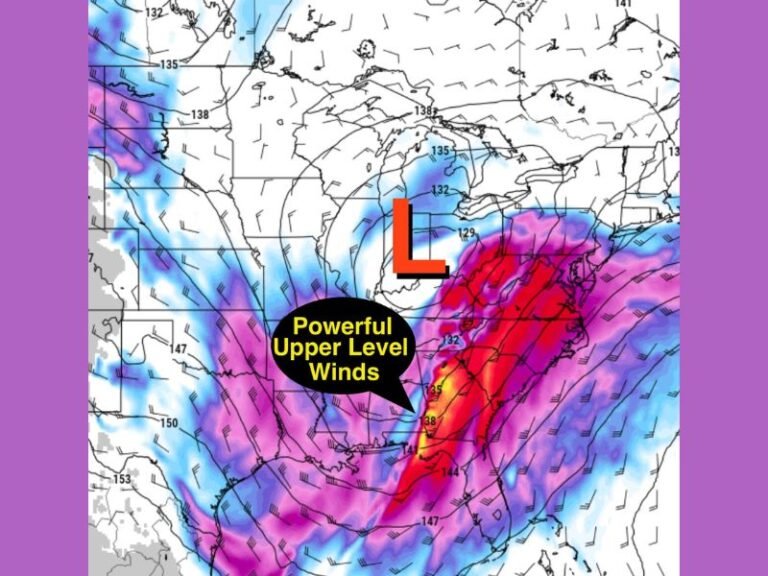
Strong to Severe Storms Sweep Southeast Across Northern Illinois and Indiana Saturday Morning With Additional Round of Severe Weather Likely This Evening
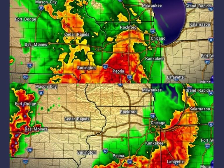
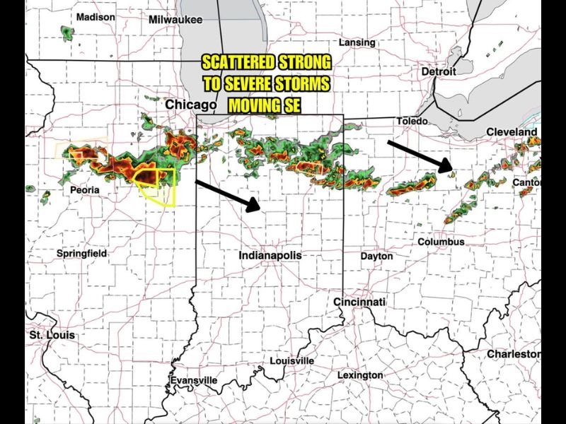
CHICAGO, IL — A line of scattered strong to severe thunderstorms is pushing southeastward across northern Illinois and Indiana Saturday morning June 6, 2026, with BAM Weather radar captured at 6:20 AM ET showing an organized and active storm line stretching from the Peoria corridor eastward through the Chicago area and continuing into northern Indiana and toward the Toledo and Columbus Ohio corridor as the system tracks aggressively toward the southeast.
Morning Storm Line Spans Hundreds of Miles
Radar imagery at 6:20 AM ET Saturday shows a continuous and well-organized line of storm activity with intense red and orange reflectivity values embedded within the broader green precipitation shield, indicating the presence of strong to severe capable storm cells distributed across a lengthy storm line stretching from central Illinois near Peoria and Springfield eastward through the Chicago metropolitan area and extending into northern Indiana and approaching the Toledo corridor to the northeast.
An active severe thunderstorm warning polygon is visible near Peoria at the time of the radar capture, confirming that at least one cell within the morning storm line has already reached severe criteria with the ability to produce damaging winds, large hail, or both as it tracks southeastward through the region during the early morning hours.
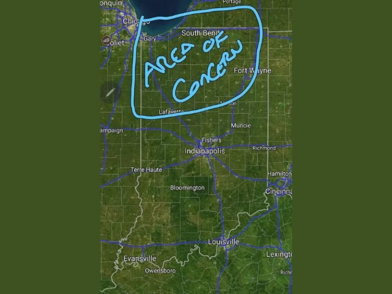
Severe Risks Taper as Storms Track East
While the morning storm line carries genuine severe weather potential across northern Illinois and northern Indiana during the early Saturday hours, forecasters indicate that severe risks associated with the morning round will gradually diminish as the storm system continues its southeastward progression and tracks further into Indiana and Ohio during the mid morning timeframe.
The tapering of severe weather risk as the storms move east reflects the decreasing atmospheric instability behind the storm line’s leading edge, as the pre-dawn and early morning atmosphere provides less convective fuel for storm intensification compared to the peak afternoon heating hours when instability values are maximized across the region.
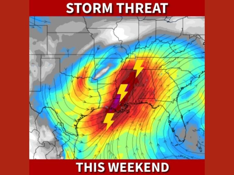
Evening Round Expected to Be More Significant
Despite the morning storm activity, forecasters are emphasizing that additional strong to severe storms are likely to develop across northern Illinois and Indiana during the Saturday evening hours, representing a second and potentially more impactful severe weather round than the morning system currently moving through the region.
The evening storm development will be driven by daytime heating rebuilding atmospheric instability across the region after the morning storms clear, with the surface boundary left behind by the morning system providing a focal point for new convective initiation during the afternoon and evening hours across the Chicago and Indianapolis corridors.
For continuing coverage of Illinois and Indiana severe weather and storm impacts across the United States, visit SaludaStandard-Sentinel.com.