Five Day Severe Storm Outbreak Threatens Central United States Through Tuesday With Tornadoes Damaging Winds and Large Hail Expected to Peak in Intensity by Monday
OMAHA, NE — A significant and escalating severe weather pattern is set to impact a large portion of the central United States over the next five days, with severe storms expected to continue through at least Tuesday. The threat will gradually intensify with each passing day, with the greatest and most widespread tornado potential anticipated by Monday as the event reaches its peak.
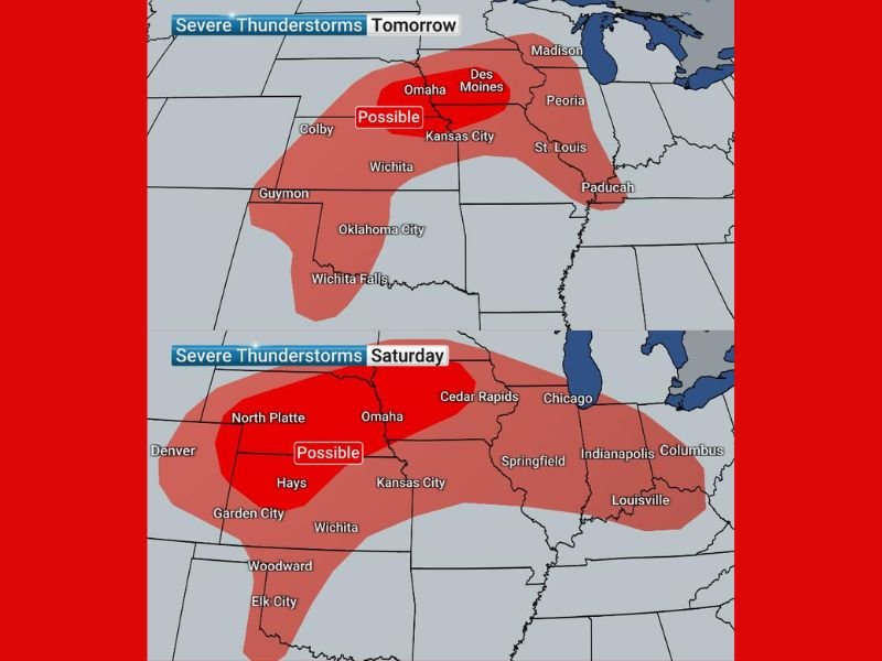
Friday and Saturday Bring Damaging Winds and Hail From Wisconsin to Texas
On Friday, the I-80 corridor stands as the primary target for severe storm activity, though widespread storms are possible across a broad area stretching from Wisconsin south through Texas. The main threats for Friday are damaging winds and large hail, with tornado risk remaining minimal. Saturday brings a similar setup, placing Iowa, Nebraska, and Kansas on alert once again for wind and hail threats.
An isolated tornado cannot be ruled out on Saturday across those states, though the overall tornado threat remains secondary to the wind and hail hazards. Communities along and near the I-80 corridor should remain weather-aware through the weekend as the pattern continues to evolve.
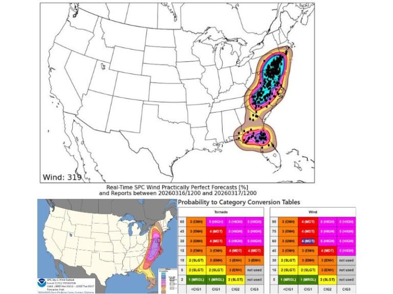
Sunday Tornado Threat Signals Start of a Potential Two to Three Day Outbreak
Sunday marks a notable shift in the severe weather pattern, with tornadoes becoming more probable across Minnesota, Iowa, South Dakota, and Nebraska. Forecast maps show a likely tornado corridor developing across the Upper Midwest, with a possible risk zone extending further south into the Plains. Meteorologists indicate Sunday could represent the beginning of a two to three day tornado outbreak sequence.
The geographic spread of the Sunday threat across multiple northern Plains and Upper Midwest states reflects the increasing organization of the atmospheric setup driving this prolonged severe weather event.
Monday Expected to Be the Peak of the Five Day Severe Weather Event
Monday is forecast to be the most significant and dangerous day of the entire five day event. Tornadoes look increasingly likely across Iowa, Nebraska, and Kansas, with a large area of severe storm potential stretching from the Great Lakes region all the way south into Texas. The likely tornado risk zone on Monday encompasses a densely populated corridor including Omaha, Des Moines, Kansas City, and Wichita.
The scale of Monday’s potential storm coverage, combined with the elevated tornado probability, makes it the day of greatest concern for communities across the central United States throughout this outbreak period.
Tuesday Carries Tornadic Storm Threat From Illinois to Oklahoma
Tuesday remains the furthest out in the forecast window and carries the most uncertainty of any day in this five day sequence. Despite that uncertainty, tornadic storm potential exists across a corridor running from Illinois southward through Oklahoma, encompassing Kansas City, Wichita, Tulsa, and Oklahoma City among other population centers.
Residents across all states in the outlined threat zones are urged to prepare now, establish a severe weather plan, and monitor forecast updates closely as conditions develop. Storm fatigue should be avoided throughout this multi-day event, as each day carries its own distinct and serious threat.
For continuing coverage of severe weather outbreaks and critical storm forecasts across the United States, visit SaludaStandard-Sentinel.com.