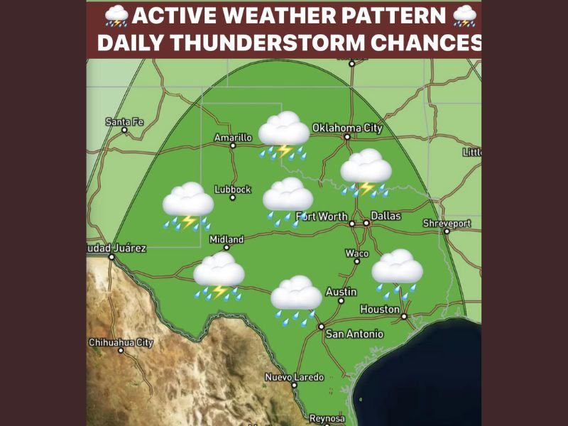
Active Weather Pattern Returns to North Texas Next Week With Daily Thunderstorm Chances Stronger Storms and Localized Flooding Concerns Expected Through Tuesday
DALLAS, TX — A stretch of sunny and quiet weather across North Texas is coming to an end as an active and increasingly unsettled pattern builds into the region next week. Beginning as early as Sunday night and intensifying through Tuesday, daily thunderstorm chances are expected to impact a broad area covering North and West Texas, with the Dallas and Fort Worth metroplex among the areas under close watch as the pattern develops.
Sunday Night Brings First Round of Storms Along the Dryline
A few light elevated showers may develop Saturday night, though most areas are expected to remain dry through that period. The more meaningful rain chances arrive Sunday night as thunderstorms develop along the dryline in West Texas and push into North Texas overnight, bringing scattered showers, lightning, and a few thunderstorms to the region.
Monday marks the beginning of a more organized and active pattern as a stronger disturbance approaches ahead of an advancing cold front. Rain and storm chances increase to around 60 percent on Monday, with the better severe weather threat currently favoring areas mainly northwest of the metroplex.
Tuesday Stands as the Most Significant Day of the Pattern
Tuesday is the day meteorologists are monitoring most closely across North Texas. As the front moves closer and instability increases across the region, stronger storms will be possible alongside heavy rainfall driven by deep Gulf moisture pushing northward. Some areas could experience very heavy downpours and localized flooding concerns during this period.
The combination of increased atmospheric instability, a deepening moisture feed from the Gulf, and a approaching frontal boundary makes Tuesday the highest impact day of the entire weekly pattern for communities across North and Central Texas.
Forecast Confidence Lowers by Wednesday as Front Position Remains Uncertain
Beyond Tuesday, forecast confidence drops considerably depending on where the cold front ultimately settles. The front may push through North Texas, stall overhead, or remain just north of the area, each scenario carrying different rainfall and storm outcomes for the region. Regardless of the front’s exact position, daily rain chances are expected to continue through much of the remainder of the week.
The second half of May across North Texas is shaping up to be considerably more unsettled than the calm stretch residents have experienced recently, with widespread rainfall beneficial for lawns and drought-stressed landscapes expected by month’s end.
For continuing coverage of active weather patterns and severe storm forecasts across the United States, visit SaludaStandard-Sentinel.com.