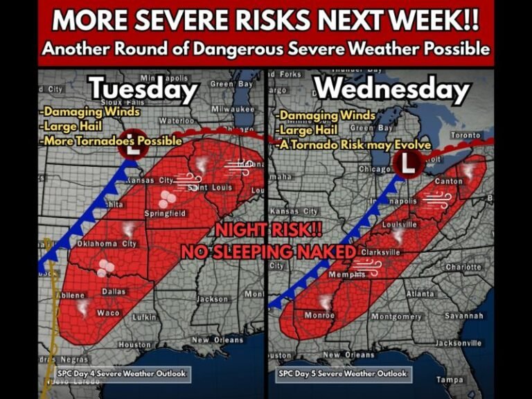
Sunday Shapes Up as Highest Impact Severe Weather Day for Oklahoma and North Texas With Multiple Tornadoes Possible Across OKC, Tulsa, Dallas and Surrounding Areas
OKLAHOMA — Sunday is shaping up to be the most significant and highest impact severe weather day of the upcoming multi-day severe weather event for Oklahoma and surrounding states. Forecasters describe the atmospheric setup as a nearly perfect environment supportive of all modes of severe weather, including the possibility of multiple tornadoes during the afternoon, evening, and nighttime hours.
Most of Oklahoma, including Oklahoma City and Tulsa, falls within the primary risk area. The threat extends into north Texas, south-central and southeast Kansas, southwest Missouri, and Arkansas, placing millions of residents across multiple states under a serious severe weather threat Sunday.
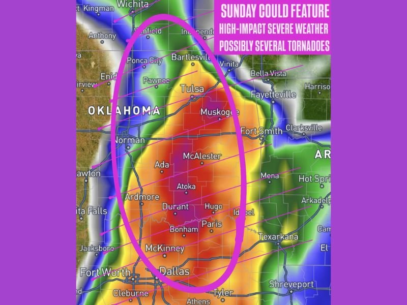
Primary Threat Zone Covers Oklahoma City to Dallas Corridor
The highest risk area on Sunday is concentrated across a broad corridor stretching from the Oklahoma City and Tulsa metro areas southward through McAlester, Ada, Atoka, Durant, and Hugo in Oklahoma, continuing into north Texas communities including Paris, Bonham, McKinney, and Dallas.
This corridor, highlighted on forecast maps, sits within a zone of intense atmospheric instability where storm development is expected to be rapid and significant during the afternoon hours. Forecasters are particularly concerned about the evening and overnight hours when tornado-producing storms can be especially dangerous due to reduced visibility.
Surrounding States Also at Risk Sunday
Beyond Oklahoma and Texas, the severe weather risk on Sunday extends into several surrounding states. South-central and southeast Kansas, including communities near Wichita and Independence, fall within the broader threat area. Southwest Missouri and portions of Arkansas, including Fort Smith and surrounding communities, are also included in the risk zone as the severe weather pattern expands eastward through the day.
Forecasters note that all guidance is consistently bullish on the severe weather setup for Sunday, meaning there is high confidence across multiple forecast models that conditions will support organized and dangerous storm activity across the entire region.
Multiple Tornadoes Considered a Real Possibility
One of the most serious aspects of Sunday’s forecast is the explicit mention of multiple tornadoes as a possibility during the afternoon, evening, and nighttime hours. Forecasters describe the environment as supportive of all modes of severe weather, a designation that includes supercell thunderstorms, large hail, damaging straight-line winds, and tornado activity.
Residents across Oklahoma, north Texas, and surrounding areas are being urged to have a clear and practiced severe weather safety plan in place well before Sunday arrives. Knowing your shelter location, having a weather alert device, and staying connected to local forecasts throughout the day Sunday will be critical steps for everyone in the threat zone.
Special Concern for OKC as Major Weekend Events Draw Crowds
Forecasters specifically noted that this weekend is a major event weekend for Oklahoma City, with visitors coming from around the world. The combination of large crowds and a high-impact severe weather day on Sunday makes public awareness and preparedness even more critical than usual.
All residents and visitors in the Oklahoma City area are asked to stay weather aware throughout the entire weekend, from Friday through Sunday, and to have a plan for quickly reaching safe shelter if warnings are issued.
Are you in Oklahoma, north Texas, or surrounding states preparing for Sunday’s severe weather threat? Share your plans and stay informed with the latest coverage at SaludaStandard-Sentinel.com.