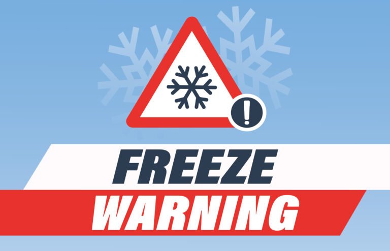
North Carolina Winter Weather Advisory Issued as Rain Changes to Snow, Sleet, and Freezing Rain Overnight Into Thursday
NORTH CAROLINA — A Winter Weather Advisory has been issued across much of central and eastern North Carolina as a cold front moves through the state, creating the potential for slick roads, light snow, sleet, and pockets of freezing rain from Wednesday night into Thursday morning, forecasters say.
While this is expected to be a minor winter weather event, officials are urging drivers to remain cautious, especially during the Thursday morning commute, when temperatures dip near or below freezing and moisture refreezes on road surfaces.
Cold Front Brings Mixed Precipitation Overnight
According to meteorologists, a low-pressure system paired with a cold front is moving across North Carolina, bringing periods of rain during the day Wednesday. As colder air pushes in behind the front Wednesday evening and overnight, rain may transition into snow, sleet, or freezing rain, particularly after sunset.
The greatest concern is not heavy snowfall, but rather slick travel conditions caused by refreezing moisture on bridges, overpasses, and elevated roadways.
Most areas are expected to see minimal to no accumulation, though localized snow or sleet totals up to one inch are possible in heavier bands, especially in higher elevations and parts of the northern Piedmont.
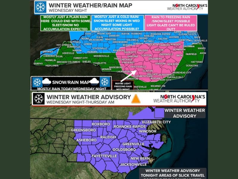
Areas Most at Risk for Slick Roads
Forecasters have outlined three primary impact zones across the state:
- Central North Carolina (Blue Zone): Rain may mix with snow or sleet overnight, with isolated light accumulations possible. Freezing rain cannot be ruled out in spots where temperatures fall below 32 degrees.
- Eastern North Carolina (Pink Zone): Rain is expected to switch to scattered snow showers, sleet, or light freezing rain late tonight into early Thursday. A light glaze of ice on elevated surfaces is possible.
- Western and Southern Areas (Dark Green Zone): Mainly cold rain, with only isolated snowflakes or sleet late Wednesday night and little to no impact expected.
Counties included in the advisory stretch from the Triangle region through eastern North Carolina, covering major population centers including Raleigh, Durham, Greensboro, Fayetteville, Goldsboro, Greenville, and Jacksonville.
Thursday Morning Commute Could Be Impacted
Officials warn that overnight refreezing could create hazardous conditions early Thursday, particularly before temperatures rise mid-morning.
Drivers are advised to:
- Reduce speed and increase following distance
- Use caution on bridges, overpasses, and untreated roads
- Delay travel until mid-morning if possible
Pedestrians should also be careful on sidewalks, driveways, and parking lots, where thin ice may not be visible.
What to Expect Next
This system is expected to exit the region by late Thursday morning, with gradual improvement in road conditions as temperatures climb. No major winter storms are anticipated with this event, and forecasters emphasize that panic is not warranted.
However, even minor winter weather can lead to accidents and injuries if precautions are ignored. Residents are encouraged to stay alert to local updates and plan ahead for potentially slick travel conditions overnight and early Thursday.
For continued coverage of winter weather updates, road conditions, and safety alerts across the Carolinas, stay with SaludaStandard-Sentinel.com and share your local conditions with our newsroom.