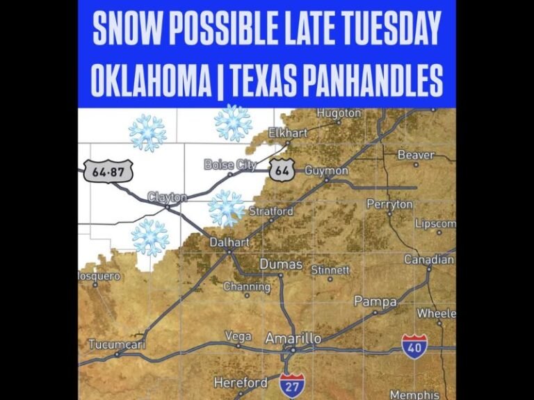
Tornado Warning Issued for Velma Oklahoma as Lead Supercell Shows Strengthening Rotation Moving Southeast With Golf Ball Size Hail Confirmed on Board
VELMA, OK — A Tornado Warning has been issued for Velma, Oklahoma as a lead supercell thunderstorm displays rapidly strengthening rotation while tracking southeastward through the region, with the storm simultaneously carrying a significant hail threat featuring stones up to at least golf ball size capable of causing widespread damage across all communities falling within the warning polygon.
Tornado Warning Issued as Rotation Strengthens
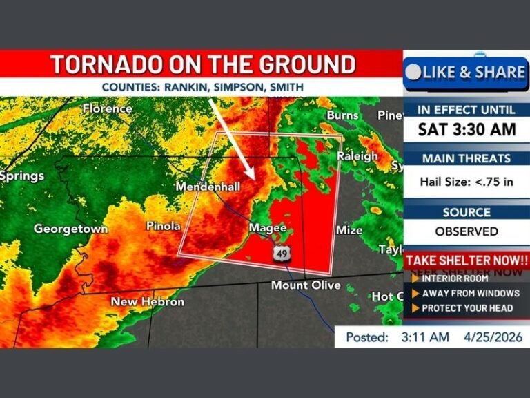
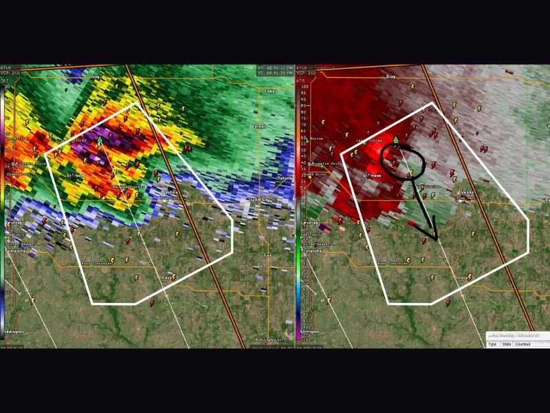
The Tornado Warning covering Velma and surrounding communities reflects a dangerous and rapidly evolving situation on radar, where the lead supercell is displaying clear and unmistakable signs of intensifying rotation as it advances to the southeast. Dual radar imagery captured at the time of the warning shows a well-defined circulation signature on the velocity scan, with the classic rotation couplet clearly visible and tightening as the storm organizes into a more structured and dangerous configuration.
The strengthening nature of the rotation is particularly concerning as it suggests the storm is in an intensifying rather than weakening phase, meaning conditions within the warning polygon could deteriorate further in the minutes following the warning issuance.
Velocity Scan Confirms Dangerous Rotation Couplet
Side-by-side radar analysis showing both reflectivity and storm-relative velocity data confirms the presence of a well-organized and tightening rotation couplet within the warned supercell. The velocity imagery clearly depicts the inbound and outbound wind signatures characteristic of a rotating mesocyclone, with the circulation annotated directly on the radar display highlighting the precise location of the most dangerous rotational activity within the storm as it tracks toward communities in its southeastern path.
This type of confirmed and strengthening velocity couplet is precisely the radar signature that prompts Tornado Warning issuance from the National Weather Service, reflecting the elevated probability of tornado development at or near the surface beneath the rotating storm.
Golf Ball Size Hail Adds to Dangerous Storm Profile
Beyond the tornado threat, the warned supercell is carrying a substantial hail load with stones confirmed at least golf ball size, measuring approximately 1.75 inches in diameter. Hail of this size is capable of shattering vehicle windshields, severely damaging roofing materials, destroying crops, and injuring anyone caught outdoors without adequate shelter during the storm’s passage through the affected communities.
Residents across Velma and all communities within the Tornado Warning polygon are urged to seek immediate shelter in the lowest interior room of a sturdy structure and remain there until the warning expires or is officially cancelled by the National Weather Service.
For continuing coverage of severe weather events and critical storm analysis across the United States, visit SaludaStandard-Sentinel.com.