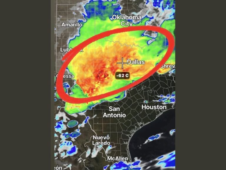
Texas, Oklahoma, Kansas, and Missouri Face Major Severe Weather Outbreak With EF-3 Tornadoes, Damaging Winds, and Large Hail Possible Saturday
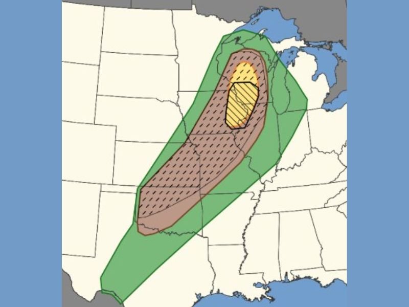
TEXAS TO MISSOURI — Forecasters are expressing serious concern about a potentially dangerous severe weather outbreak expected to develop Saturday across a large corridor stretching from Texas through Oklahoma, Kansas, and into Missouri. The threat is forecast to begin as early as noon and last into the late evening hours, with widespread damaging winds, large hail, and intense EF-3 or stronger tornadoes all considered possible across the affected region.
The setup is being described as a high-risk type scenario, with the atmosphere expected to provide an incredibly favorable environment for strong to intense tornado development, particularly for any storms that manage to remain discrete and organized throughout the day.
Outbreak Timeline and Key Threats
The severe weather outbreak is expected to fire as early as noon Saturday and continue through the late evening hours, giving the storm system a wide window to produce significant and potentially historic damage across multiple states. The three primary threats forecasters have identified are widespread damaging winds capable of destroying structures and downing trees, large hail that can damage vehicles and rooftops, and intense tornadoes potentially reaching EF-3 intensity or stronger.
Residents across the entire risk corridor should have their severe weather plans finalized well before noon Saturday, as conditions can deteriorate rapidly once storm development begins during the afternoon heating hours.
High Risk Setup Dependent on Storm Mode
The critical variable determining just how severe Saturday’s outbreak becomes is storm mode — whether individual storms remain discrete and separated or merge into a more linear and disorganized squall line. Forecasters explained that discrete supercell storms would be working with an incredibly favorable atmospheric environment for producing strong to intense tornadoes, making that scenario the most dangerous possible outcome for the region.
If storm mode trends more linear and messy, the tornado threat decreases somewhat but the damaging wind threat increases significantly, with strong tornadoes still possible even in that less favorable scenario. Either outcome represents a serious life-threatening severe weather event for millions of residents across the affected states.
What Residents Must Do Before Saturday Noon
With the threat beginning as early as noon, residents across Texas, Oklahoma, Kansas, and Missouri have limited time to prepare. Every household in the risk zone should identify their designated tornado shelter location now, whether that is a basement, interior room on the lowest floor, or a community shelter facility nearby.
Ensure emergency supply kits are stocked, devices are fully charged, and multiple methods of receiving warnings are active and functional. Do not rely solely on outdoor warning sirens — a weather radio or smartphone alert app provides the fastest and most reliable warning delivery directly to you.
Are you in the path of Saturday’s severe weather outbreak? Share your preparations and stay connected with our continuing coverage at SaludaStandard-Sentinel.com.