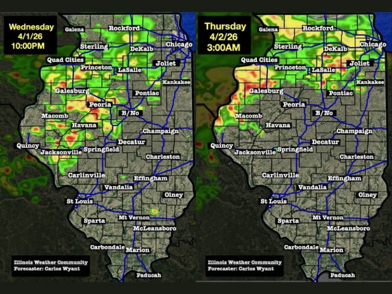
Active Storm Pattern Returns to Kentucky Through Wednesday Night With Up to 3.3 Inches of Rainfall Expected and Stronger Storms Possible Across Western Kentucky Tuesday
LOUISVILLE, KY — An active and increasingly stormy weather pattern is building across Kentucky over the next several days, with showers and thunderstorms expected to crank up through Wednesday night as rainfall totals accumulate across the state. Rainfall forecast graphics valid through Wednesday at 11:00 PM show widespread accumulations of 1.5 to 3.3 inches across central and south central Kentucky, with additional rainfall expected during the long range period beyond Wednesday night.
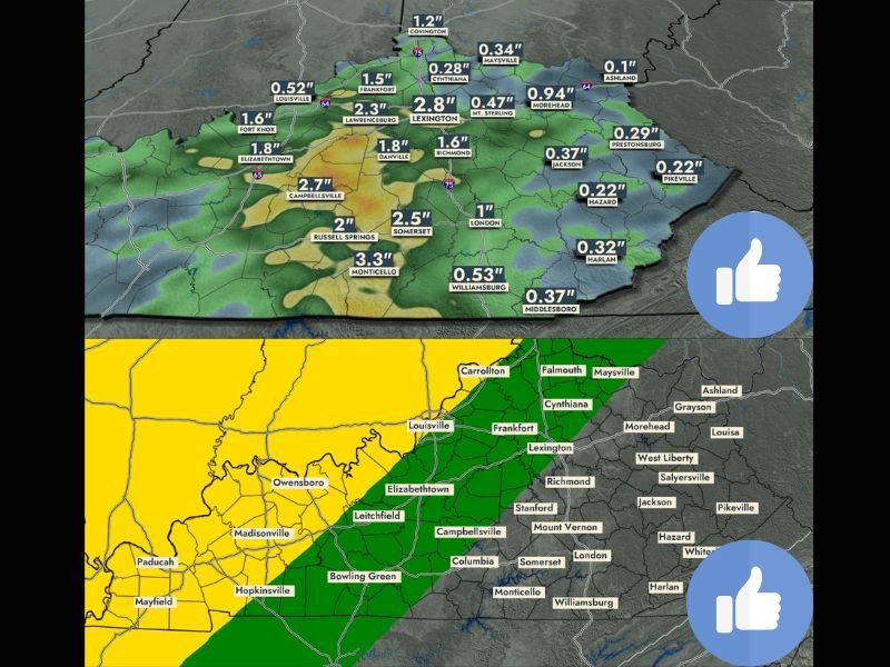
Rainfall Totals Through Wednesday Night Show Heaviest Accumulations Across Central Kentucky
Forecast rainfall totals through Wednesday at 11:00 PM show the heaviest accumulations concentrated across central and south central Kentucky, with Monticello projected to receive 3.3 inches, Campbellsville 2.7 inches, and Lexington 2.8 inches over the period. Somerset is forecast to receive 2.5 inches, Russell Springs 2 inches, and Lawrenceburg 2.3 inches, while Elizabethtown and Danville are each projected near 1.8 inches through the Wednesday night cutoff.
Eastern Kentucky communities including Morehead, Jackson, and Hazard are forecast to receive lighter totals ranging from 0.22 to 0.94 inches, while the Louisville corridor sits near 0.52 inches through the same period, reflecting a west to east gradient in rainfall totals across the state.
Stronger Storms and Slight Severe Threat Possible Across Western Kentucky Tuesday
Tuesday brings the most significant severe weather concern of the multi-day period, with a slight severe weather threat zone covering western Kentucky including Louisville, Owensboro, Bowling Green, Hopkinsville, and Madisonville. A marginal severe threat extends eastward through Frankfort, Elizabethtown, and Campbellsville, while central and eastern Kentucky communities fall within a general thunderstorm risk zone without an elevated severe designation.
Better chances for stronger storm development are expected to focus across western Kentucky as the Tuesday system moves through, with forecast confidence expected to increase significantly within 24 hours of the event.
Additional Rainfall Expected Beyond Wednesday as Pattern Remains Unsettled
The rainfall totals projected through Wednesday night do not represent the full precipitation potential for the region, as additional shower and thunderstorm chances are expected to continue through the long range period beyond Wednesday. Kentucky residents across all regions are encouraged to monitor forecast updates closely through the week as the active pattern persists and storm timing becomes clearer.
For continuing coverage of rainfall forecasts and storm threats across the United States, visit SaludaStandard-Sentinel.com.