Temperatures Surging to 87 Degrees With Stronger Storm Threat Monday Across Northern Illinois and Southern Wisconsin as Warming Pattern Builds Through May 14 to 20 Before Cold Front Arrives
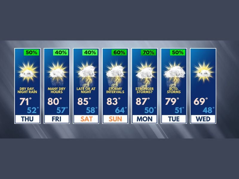
NORTHERN ILLINOIS/SOUTHERN WISCONSIN — A significant warming trend is building across the Northern Illinois and Southern Wisconsin Stateline region through the May 14 to 20 forecast period, with temperatures surging to 87 degrees by Monday as the warmest and most humid day of the stretch brings the strongest storm potential, before a cold front arriving Monday night or Tuesday ends the active weather pattern and sends temperatures back toward normal.
Thursday Dry Before Showers Arrive Thursday Night
Thursday delivers a dry and seasonable day with temperatures returning close to mid-May norms at 71 degrees, offering a pleasant break before the active pattern develops. Showers and a few embedded rumbles of thunder will encroach upon the region later Thursday night, signaling the beginning of the more active weather stretch that carries through the weekend and into early next week across the Stateline area.
Overnight lows will drop to 52 degrees Thursday as the moisture begins increasing ahead of the warming trend.
80s Return Friday and Saturday With Mostly Dry Conditions
Friday brings a welcome return to the 80s with a high of 80 degrees and many dry hours despite a 40 percent shower chance, while occasional storms remain possible through the day. Saturday pushes temperatures to 85 degrees with storm chances holding off until late afternoon or nighttime, delivering many dry and warm hours across the region.
Importantly, any storms through Saturday are not expected to be severe due to a relative lack of moisture, and warm temperatures will feel comfortable rather than oppressively humid through the weekend daytime hours.
Monday the Key Day With 87 Degrees and Stronger Storms
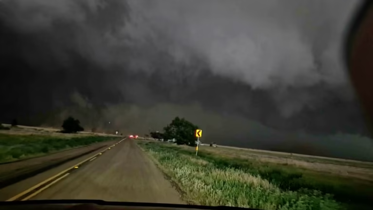
Monday emerges as the most critical day of the entire forecast period, when temperatures peak at 87 degrees alongside the highest humidity levels of the stretch, creating conditions that could support more explosive thunderstorm development across Northern Illinois and Southern Wisconsin. Storm chances reach 70 percent Monday with stronger storms possible, though forecasters note no severe weather alarm bells need to be sounded at this time as forecast details continue evolving.
A cold front passing Monday night or Tuesday will end thunderstorm chances and push temperatures back toward or slightly below normal by midweek, with Wednesday dropping to 69 degrees.
For continuing coverage of severe weather events and critical storm analysis across the United States, visit SaludaStandard-Sentinel.com.