Showers Pushing Eastward Across Indiana, Kentucky, and Ohio Covering Indianapolis, Louisville, and Cincinnati Saturday Morning With No Severe Hazards
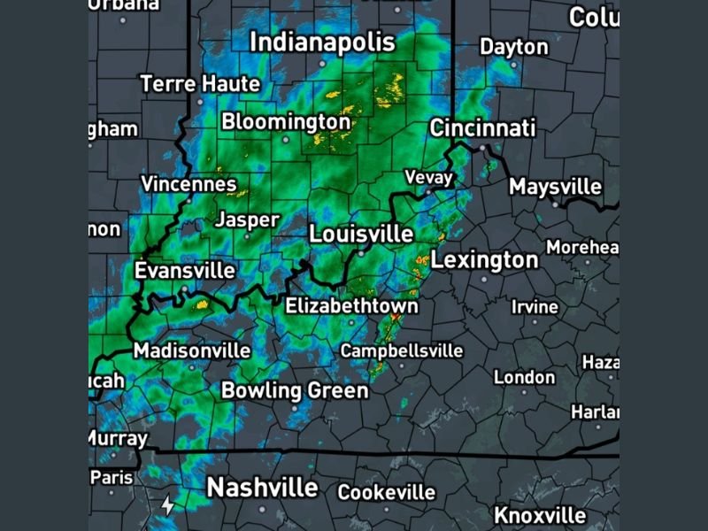
INDIANA, KENTUCKY, AND OHIO — A broad area of showers was continuing to push eastward across Indiana, Kentucky, and Ohio at 11:05 AM Eastern Saturday, April 18, 2026, with radar showing widespread green and yellow returns blanketing a large corridor from Evansville and Terre Haute through Indianapolis, Louisville, Cincinnati, and into the Lexington area. Forecasters confirmed that no real hazards were associated with the ongoing shower activity, offering reassurance to residents across the affected region after a week of intense and dangerous severe weather.
The shower band was covering a significant swath of the tri-state region, with the heaviest pockets of rainfall concentrated near Bloomington, Indiana and isolated areas near Elizabethtown and Campbellsville in Kentucky at the time of the 11:05 AM update.
Shower Coverage Across the Region
Radar imagery showed the eastward-moving shower band stretching across a wide corridor of communities Saturday morning. Across Indiana, the showers were impacting Indianapolis, Bloomington, Terre Haute, Vincennes, Jasper, and Evansville as the system continued its steady eastward progression. The shower activity extended northward toward Dayton and Columbus in Ohio while simultaneously pushing into the Louisville and Lexington corridor in Kentucky.
Further south, communities including Bowling Green, Elizabethtown, and Campbellsville in Kentucky were also seeing active shower coverage, with isolated pockets of heavier rainfall indicated by yellow returns on radar near the Campbellsville area at the time of the update.
No Severe Hazards With Current Shower Activity
Forecasters confirmed at 11:05 AM that despite the widespread shower coverage across the region, no real severe weather hazards were associated with the ongoing precipitation. This is welcome news for residents across Indiana, Kentucky, and Ohio who endured a prolonged and dangerous stretch of severe weather throughout the week, including tornadoes, damaging winds, large hail, and significant flooding across multiple states.
The non-severe nature of Saturday morning’s showers means residents can go about their weekend activities with appropriate rain gear without significant concern for dangerous weather conditions developing from this particular system.
What to Expect as Showers Continue East
As the shower band continues its eastward progression through Saturday morning and into the afternoon, communities further east across Kentucky and Ohio should expect the rain to arrive or intensify during the midday hours. Areas including Lexington, Morehead, Cincinnati, and Dayton are all positioned to see the shower activity push through as the system tracks east.
Behind the shower band, conditions are expected to gradually improve across the western portions of the affected region as the rain moves away and drier air begins to filter in during the afternoon hours.
Are you seeing rain from Saturday morning’s shower band across Indiana, Kentucky, or Ohio? Share your conditions and stay connected at SaludaStandard-Sentinel.com.