Nearly 9 Inches of Rain Drenches Baton Rouge Louisiana in 72 Hours Surpassing Two Months Worth of Rainfall for Some Areas as Extreme Flooding Threatens the Greater Metro Region
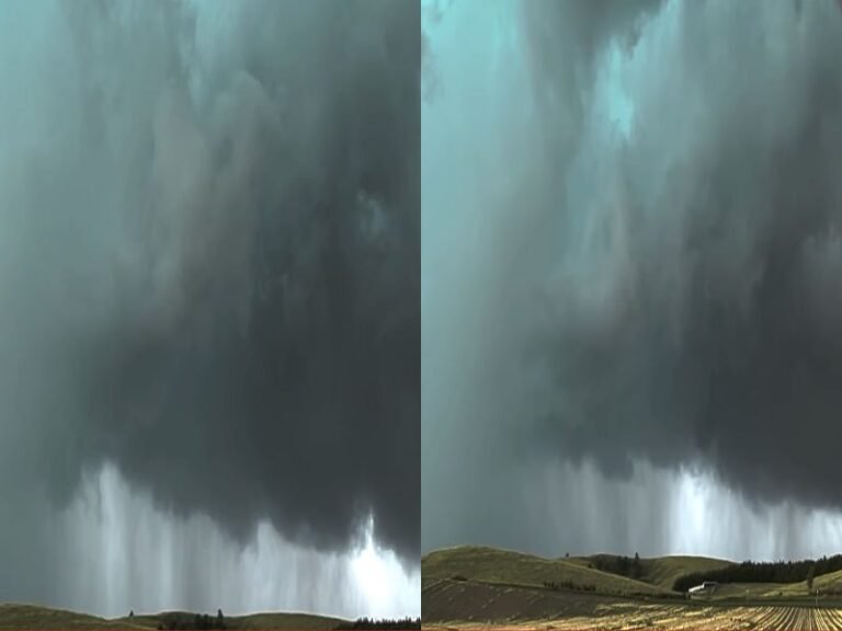
BATON ROUGE, LA — An extraordinary and potentially historic rainfall event has delivered 8.81 inches of precipitation across Baton Rouge, Louisiana within a 72-hour period, a total that surpasses the entire two-month rainfall accumulation for some portions of the region and has placed the greater Baton Rouge metropolitan area under severe and widespread flooding conditions across neighborhoods, roadways, and drainage infrastructure throughout the city and surrounding communities.
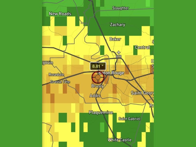
8.81 Inches of Rain in 72 Hours Confirmed
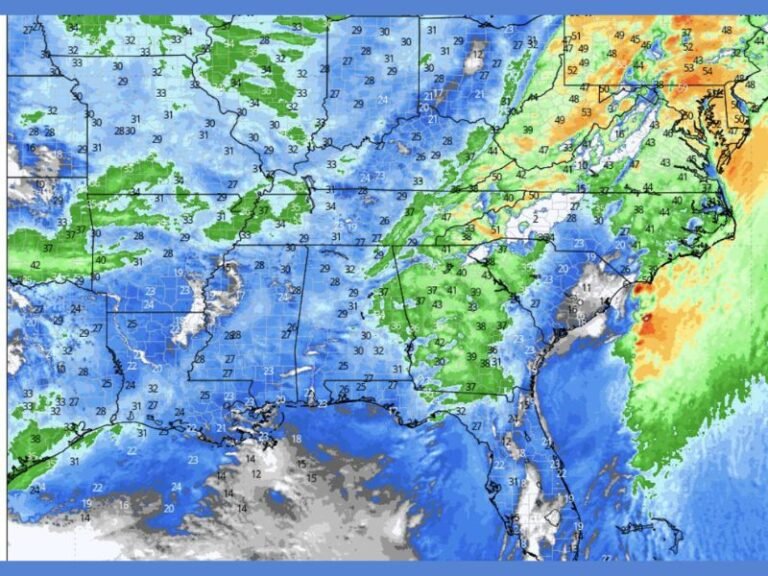
Rainfall accumulation data confirms the 8.81-inch total directly over the Baton Rouge and Brusly area, with the measurement bullseye centered precisely over the heart of the metropolitan region as depicted on radar-estimated precipitation imagery.
The surrounding communities of Zachary, Baker, Central, Addis, Plaquemine, and Saint Gabriel also show significant accumulation returns across the broader rainfall footprint, indicating that the extreme precipitation event is not isolated to a single point but has impacted a wide geographic area across East and West Baton Rouge parishes simultaneously.
A 72-hour rainfall total approaching 9 inches represents an event of extraordinary hydrological significance for any urban region, and particularly for Baton Rouge where existing drainage infrastructure faces severe capacity challenges during even moderate rainfall events.
Rainfall Total Exceeds Two Months Worth of Precipitation
To contextualize the scale of this rainfall event, the 8.81 inches recorded across Baton Rouge in 72 hours exceeds the total precipitation that some portions of the region typically receive across an entire two-month period. This level of rainfall compression into such a short timeframe overwhelms natural drainage systems, saturates soil to complete capacity, and fills waterways well beyond their normal banks across the affected parishes.
The cumulative nature of the rainfall across three consecutive days means that ground saturation reached critical levels long before the final totals were recorded, meaning even later rainfall amounts that would otherwise be manageable contributed disproportionately to flooding conditions across the region.
Drainage Infrastructure Under Extreme Stress
The drainage systems across Baton Rouge and surrounding communities including Grosse Tete, Rosedale, New Roads, and Slaughter have been placed under extraordinary stress by the sustained and extreme rainfall accumulation over the 72-hour period. Urban drainage networks across the metropolitan area were not designed to handle rainfall input at the rate and volume delivered by this event, resulting in widespread surface flooding across streets, parking areas, low-lying neighborhoods, and commercial corridors throughout the greater Baton Rouge region.
Residents across all affected parishes are strongly urged to avoid any flooded roadways, refrain from driving through standing water of unknown depth, and monitor official emergency management communications for evacuation guidance or shelter information as conditions across the region continue to be assessed.
For continuing coverage of severe weather events and critical storm analysis across the United States, visit SaludaStandard-Sentinel.com.