Massive and Dangerous Supercell Storm Structure Photographed Northwest of Jacksboro Texas This Evening as Severe Weather Continues Sweeping Through North Texas
JACKSBORO, TEXAS — A jaw-dropping and deeply alarming supercell storm structure was captured on camera northwest of Jacksboro, Texas this evening, offering a rare and striking visual of just how powerful and organized the severe weather moving through North Texas has become.
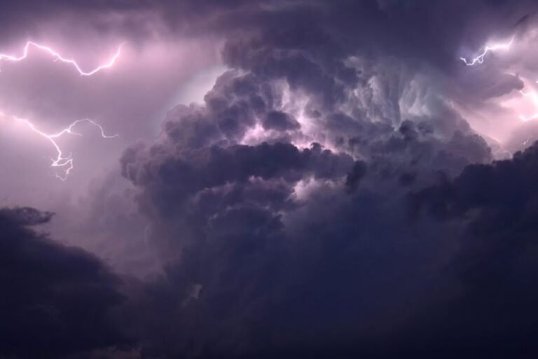
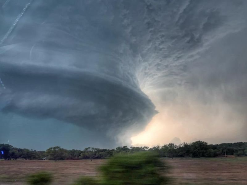
The photograph, captured by Mark Porada of LSC, shows a massive rotating wall of storm structure that reflects the dangerous atmospheric conditions currently in place across the region. The image has quickly circulated widely, drawing attention to the scale and intensity of storms impacting North Texas tonight.
What the Image Shows
The photograph captures a classic supercell structure in remarkable detail. The tightly wound, layered rotation visible in the cloud formation is characteristic of a highly organized supercell thunderstorm — the same type of storm most capable of producing large tornadoes, giant hail, and extreme damaging winds.
The wall cloud and inflow region visible at the base of the storm indicate a system that was actively drawing in warm, moist air and converting it into violent rotational energy. Storms with this level of visible organization are among the most dangerous that meteorologists track and are taken with the highest level of seriousness in any severe weather operation.
North Texas Under Significant Storm Threat Tonight
The Jacksboro area in Jack County sits in North Texas, a region that has been under active severe weather threat throughout the evening as a powerful storm system moves through. Supercells of this nature are capable of rapid intensification and can produce tornadoes, softball-size hail, and wind gusts strong enough to cause catastrophic structural damage with very little warning.
Residents in and around Jack County and surrounding North Texas communities were urged to take shelter and remain indoors as storms of this magnitude moved through the area.
Storm Photography Captures What Radar Cannot
Images like the one captured by Mark Porada serve an important public awareness purpose beyond their visual impact. They communicate in an immediate and visceral way what radar returns and forecast maps describe in data — that the storm moving through an area is not ordinary and should be taken with the utmost seriousness.
When a storm looks like this from the outside, what is happening inside is far more dangerous than any photograph can fully convey. Stay weather aware and share your North Texas storm reports and photos at SaludaStandard-Sentinel.com.