Strong Dryline Storms Tracking Toward Dallas Fort Worth Metroplex Sunday Evening With Bigger Storm Setup Arriving Monday and Continuing Into Midweek Across Texas
DALLAS, TX — Showers and thunderstorms developing along the dryline to the west Sunday afternoon are expected to push eastward toward the Dallas-Fort Worth Metroplex during the evening hours, with some storms capable of producing strong conditions early before gradually weakening overnight, while a significantly larger storm setup arrives Monday and potentially persists through midweek across Texas.
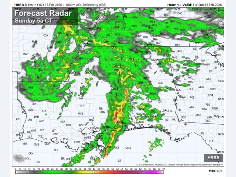
Dryline Storms Developing and Moving Toward DFW Sunday Evening
The dryline positioned across western Texas Sunday afternoon is serving as the primary trigger for storm development as moisture and instability converge along its boundary during afternoon heating hours. Storms firing along the dryline will organize and advance eastward toward the DFW Metroplex during the evening, bringing strong thunderstorm potential to Dallas, Denton, and surrounding communities.
Radar probability imagery shows the highest storm coverage concentrated along a north-south corridor from Ardmore and Denison southward through Denton, Dallas, and continuing toward Stephenville and Killeen during the Sunday evening window.
Storms Strong Early Before Weakening Overnight
The strongest storm activity is expected during the earlier portion of Sunday evening while storms remain close to their dryline initiation zone. As the line pushes further east through the overnight hours, storms are forecast to gradually weaken as they move away from the primary forcing mechanism and encounter more stable atmospheric conditions across the eastern portions of the region.
Residents across the DFW corridor and surrounding North Texas communities should keep weather alert systems active through the Sunday overnight period.
Much Bigger Storm Setup Arrives Monday Into Midweek
The more significant concern extends well beyond Sunday night, as a much larger and more impactful storm setup is forecast to arrive Monday and continue generating increasing rain and storm chances across Texas through the middle of next week. This developing pattern represents a meaningful escalation in the overall storm threat compared to the Sunday evening dryline event, with the potential for organized and widespread severe weather affecting multiple regions of the state simultaneously during the Monday through midweek timeframe.
For continuing coverage of severe weather events and critical storm analysis across the United States, visit SaludaStandard-Sentinel.com.