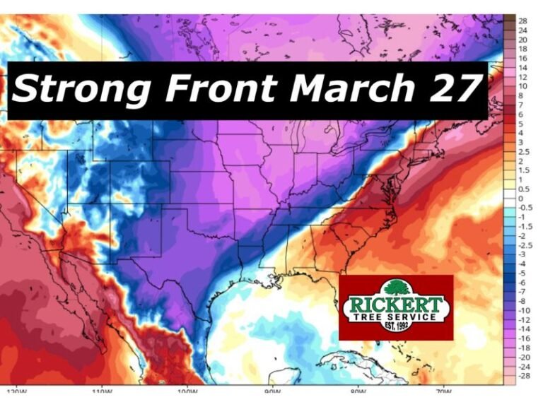
Michigan Faces Bitter Easter Morning Wind Chills Dropping Into Teens Across Upper Peninsula and 20s to Low 30s in Lower Peninsula
MICHIGAN — A sharp burst of cold air is expected to grip the state on Easter morning, with wind chill values plunging into the teens across the Upper Peninsula and into the 20s and low 30s across much of the Lower Peninsula.
The cold conditions are expected early Sunday, April 5, 2026, creating a frigid start to the holiday and prompting concerns for anyone planning to spend time outdoors.
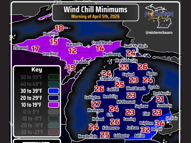
Upper Peninsula Sees Harshest Cold With Wind Chills in Teens
The coldest conditions are forecast across northern Michigan, particularly in the Upper Peninsula, where wind chills are expected to fall as low as the low teens.
Cities such as Marquette, Iron River, and Houghton could experience wind chills ranging from around 12 to 18 degrees, making it feel significantly colder than actual air temperatures.
Lower Peninsula Stays Cold With Widespread 20s
Across the Lower Peninsula, wind chills will also remain unseasonably cold for early April. Areas including Traverse City, Cadillac, Lansing, and Grand Rapids are expected to see wind chills in the mid-20s.
Further south and east, including Detroit and surrounding areas, conditions will be slightly less severe but still chilly, with wind chills ranging from the low 30s into the mid-30s.
Cold Winds Create Uncomfortable Outdoor Conditions
The combination of low temperatures and brisk winds will make outdoor conditions uncomfortable, especially during the early morning hours. Even short periods outside could feel much colder due to the wind chill effect.
Those attending Easter services or outdoor gatherings are being advised to dress in layers and prepare for winter-like conditions despite the spring season.
Wide Temperature Contrast Across the State
The data highlights a clear north-to-south contrast, with the Upper Peninsula seeing the coldest readings while southern Michigan remains slightly milder. However, nearly the entire state will experience below-normal conditions for this time of year.
The widespread nature of the cold air mass means no region will be completely spared from the chilly start.
Conditions Expected to Improve Later in the Day
As the day progresses, temperatures are expected to gradually rise, reducing the intensity of the cold conditions. However, the morning hours will remain the most impactful period. Residents are encouraged to plan accordingly and take precautions if heading out early in the day.
If you’re experiencing the cold Easter morning in your area, share your conditions with us at SaludaStandard-Sentinel.com and help others prepare for the chilly start.