Developing Super El Niño Could Shift Global Weather Patterns Bringing Cooler U.S. Summer, Drier Conditions and Reduced Hurricane Activity
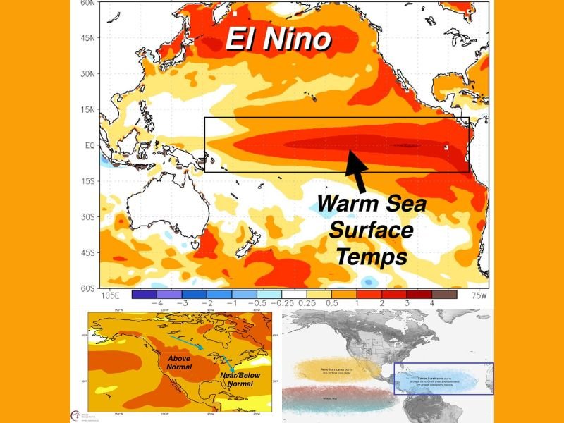
UNITED STATES — A significant shift in global weather patterns is underway as ocean data confirms the development of a strengthening El Niño in the Pacific, with signs pointing toward a potential Super El Niño event.
Scientists monitoring ocean temperatures have identified substantial warming beneath the surface in the tropical Pacific, a key indicator that this system could intensify and influence weather patterns across the United States and beyond in the coming months.
Subsurface Ocean Warming Signals Strengthening El Niño
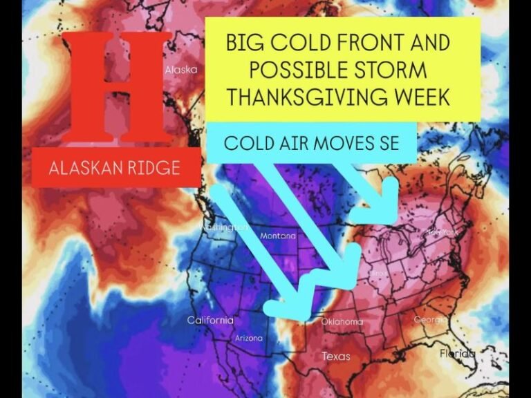
Recent oceanic analysis shows a pronounced area of warming below the surface off the western coast of South America, which is now rising and expanding across the equatorial Pacific.
This type of subsurface heat buildup is often a precursor to stronger El Niño events, as it feeds warmer sea surface temperatures over time. As this warming continues, it is expected to reinforce atmospheric changes that can alter global weather systems, including storm tracks and jet stream patterns.
Super El Niño Could Intensify Global Weather Impacts
Not all El Niño events are equal. A stronger or “Super” El Niño occurs when ocean temperatures rise significantly above average across a large portion of the Pacific.
This intensification can amplify its influence on global weather, leading to more noticeable and sometimes extreme shifts in typical seasonal patterns. These changes can include increased flooding in some regions, drought in others, and significant adjustments to how storms develop and move.
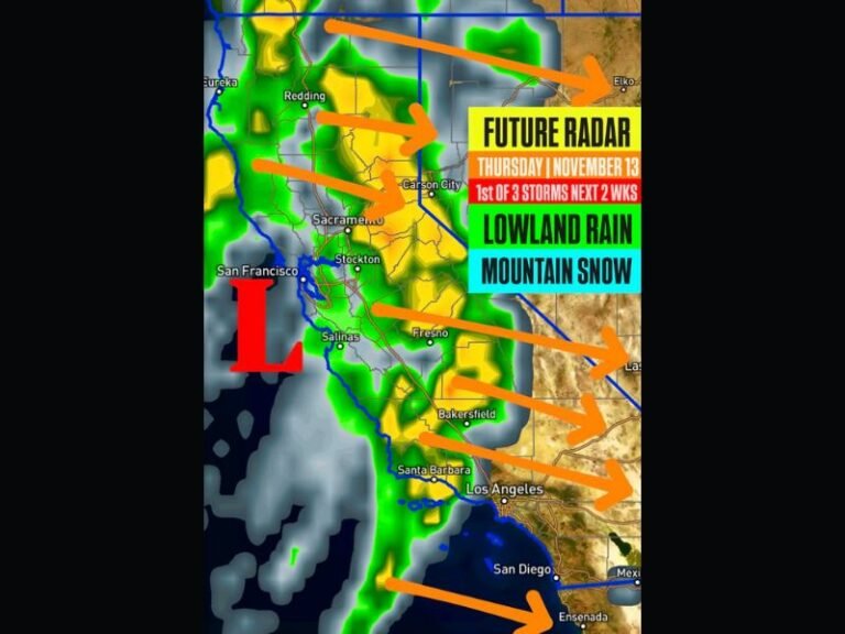
U.S. Summer May Trend Cooler With Below Normal Rainfall
Historical patterns suggest that during similar El Niño setups, parts of the United States—particularly across the central and eastern regions—can experience cooler-than-average summer temperatures.
In addition to cooler conditions, rainfall may trend below normal in several areas, depending on how the jet stream adjusts. These changes are tied to shifts in atmospheric circulation caused by the warming Pacific waters, which can redirect moisture and storm systems.
Atlantic Hurricane Season Could Be Less Active
One of the most notable impacts of a strong El Niño is its effect on the Atlantic hurricane season.
Increased wind shear over the Atlantic—caused by changes in upper-level winds—can disrupt storm development, making it harder for hurricanes to form and strengthen. As a result, hurricane activity is often reduced during strong El Niño years compared to neutral or La Niña conditions.
Global Weather Patterns Expected to Shift in Coming Months
The developing El Niño is expected to influence weather patterns across much of the Northern Hemisphere, including North America, as the system continues to evolve.
From altered rainfall patterns to shifts in temperature trends, the coming months could look noticeably different from typical seasonal expectations.
While forecasts will continue to be refined, current data points to a meaningful global weather transition already in progress. Stay informed and share your thoughts on how changing weather patterns are affecting your area by visiting SaludaStandard-Sentinel.com.