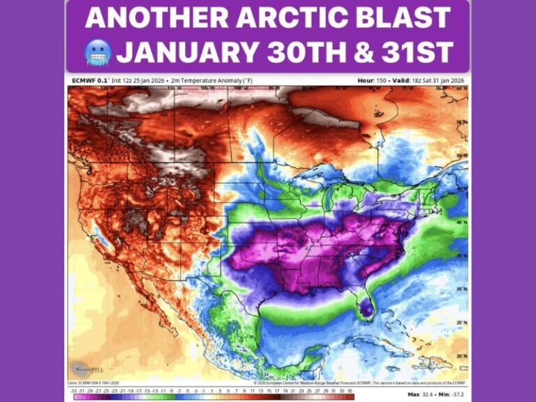
Alabama Prepares for Coldest Temperatures Since February as Hard Freeze Set to Hit Sunday Night Into Monday
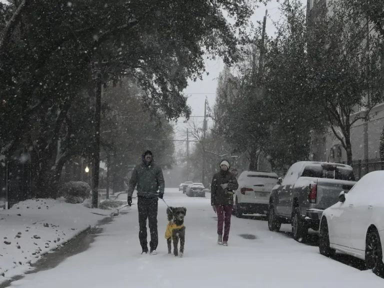
ALABAMA — A surge of bitterly cold Arctic air is expected to sweep across Alabama this weekend, bringing the state its coldest temperatures since February and delivering a prolonged stretch of subfreezing conditions from Sunday night into Monday morning. Meteorologists say this will likely be the last major cold blast for a while, but its intensity may be felt across nearly every region of the state.
Coldest Air in Months Expected to Arrive Late Sunday
Forecasters report that temperatures will drop sharply throughout the day Sunday, with feels-like values falling into the 20s during the afternoon. The formal Sunday high temperature across many Alabama communities is expected to occur around midnight, with the lowest temperatures arriving just before sunrise on Monday.
A broad swath of the state, stretching from Birmingham to Huntsville, Cullman, Anniston, and Fort Payne, is projected to spend 32 to 36 hours below freezing, according to the latest maps. Central Alabama, including Tuscaloosa, Clanton, and Selma, may experience 24 to 32 hours of subfreezing weather, while southern counties could remain below freezing for 18 to 24 hours.
Timeline of Expected Conditions From Friday Through Wednesday
Meteorologists outline a clear progression of weather changes leading into the hard freeze.
Friday will begin with chilly conditions and scattered frost in colder valleys, with early morning temperatures dipping near 32 degrees before afternoon highs rebound into the lower 60s.
Saturday brings a milder afternoon in the 60s around Birmingham, though noticeably cooler air will settle into North Alabama. A few isolated sprinkles are possible late Saturday night.
Sunday marks the arrival of the Arctic air. Temperatures will drop sharply through the day, setting the stage for dangerously cold wind chills into the evening.
Monday morning is expected to deliver the harshest conditions, with low temperatures in the teens and 20s across much of the state and highs struggling to reach the lower 40s.
Tuesday brings another freeze at sunrise, though temperatures will moderate into the 50s by afternoon.
Wednesday is expected to see lows in the mid to upper 30s, with clouds and light showers moving in later in the day.
Warmer Pattern Expected After the Cold Snap
Despite the severity of the upcoming cold outbreak, meteorologists remain confident that Alabama will soon transition into a warmer-than-average pattern. The temperature outlook for December 19–25 places most of Alabama in a zone favored for above-normal temperatures, with afternoon highs likely returning to the 60s, and possibly even low 70s in some areas.
While this warm-up will be welcomed by many, forecasters emphasize that the immediate concern remains the cold blast arriving Sunday into Monday. Residents across the state should prepare for extended periods of subfreezing temperatures, potential frost impacts, and the need to protect plants, pets, and exposed pipes.
As this developing weather pattern continues to unfold, readers are encouraged to share their observations and preparations with the community at SaludaStandard-Sentinel.com.