Wisconsin Strong Tornadoes Possible Friday as Pre-Frontal Supercells Target Southwest Region Before Dangerous Squall Line Arrives After 5 PM
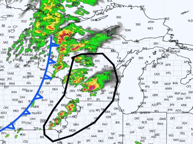
WISCONSIN — A significant and dangerous severe weather setup is taking shape for southwest Wisconsin on Friday, with meteorologists warning that pre-frontal supercells will likely develop earlier than the main squall line due to early arrival of forcing and synoptic lift from trough ejection. The atmosphere will support strong tornadoes between noon and 5 PM, with embedded circulations becoming the primary concern after 5 PM as the squall line consolidates and pushes through the region.
The early development of pre-frontal supercells is a critical detail for residents to understand, as it means dangerous tornado-producing storms could arrive well ahead of the main cold front, catching residents off guard if they are only watching for the squall line arrival.
Tornado Window Noon to 5 PM Friday
The most dangerous period for discrete supercell tornado production across southwest Wisconsin is forecast between noon and 5 PM Friday. During this window, individual supercell thunderstorms will be working with a highly favorable atmospheric environment featuring strong low-level wind shear and ample instability, creating conditions capable of supporting strong and potentially long-track tornadoes.
Storm chasers and meteorologists are already mobilizing toward southwest Wisconsin ahead of Friday’s event, underscoring the seriousness of the tornado threat during the early afternoon hours. Residents in the highest risk zone should be fully sheltered and weather-alert ready no later than 11:30 AM Friday morning.
Squall Line and Embedded Circulations After 5 PM
After the pre-frontal supercell phase winds down around 5 PM, the threat transitions to a squall line developing along the cold front. While the discrete tornado threat decreases after this transition, embedded circulations within the squall line remain possible and can produce brief but intense tornadoes with very little warning time.
The squall line phase also brings the greatest risk for widespread damaging straight-line winds across the region, capable of causing significant structural damage, widespread power outages, and dangerous debris across a broad area as the line pushes eastward through Wisconsin.
Immediate Action Required for Southwest Wisconsin Residents
Given the early noon start time for the tornado threat, residents across southwest Wisconsin cannot afford to delay preparations until Friday morning. Emergency supply kits should be stocked, shelter locations identified, and all weather alert systems activated and tested today.
Do not rely on visual confirmation of a tornado before seeking shelter — pre-frontal supercells can produce tornadoes that are rain-wrapped and difficult to see, making official warning alerts the only reliable trigger for immediate shelter action.
Are you in southwest Wisconsin preparing for Friday’s severe weather outbreak? Stay safe and follow our continuing updates at SaludaStandard-Sentinel.com.