Western Washington Storm & Thunderstorm Threat — April 15–16, 2026
WESTERN WASHINGTON — A potent storm system is delivering heavy rain, blustery winds, and significant mountain snow to the Puget Sound region on Tuesday, with forecasters warning of thunderstorms Wednesday and near-freezing temperatures expected to follow by Thursday morning.
Wind gusts have already reached 47 mph at Paine Field in Everett and a striking 69 mph in Freeland on Whidbey Island. A Wind Advisory remains in effect until 8 p.m. Tuesday across the North Sound and Whidbey Island areas, where gusts are expected to continue reaching up to 45 mph.
Evening Rain Surge Expected for Commuters
While many areas around Puget Sound have so far seen peak gusts in the 30s with limited power outages, conditions are set to intensify. A burst of heavy rain is expected to sweep through the entire Puget Sound area Tuesday evening around sunset — or shortly after — as the main frontal boundary pushes through the region.
Commuters traveling later in the evening should be prepared for a sharp deterioration in driving conditions as this frontal band moves across the area.
Heavy Mountain Snow and Winter Storm Warnings in Effect
In the Cascades, snow levels have dropped well below pass elevations, and heavy snow is expected to continue overnight Tuesday into much of Wednesday before tapering off late in the day. Winter Storm Warnings remain in effect for the mountain zones, with forecasts calling for 8 to 16 inches of new snow accompanied by gusty winds.
Travelers planning any mountain crossings Wednesday should closely monitor road conditions and allow significant extra time before heading out.
Thunderstorm Risk and Frost Threat Through the Week
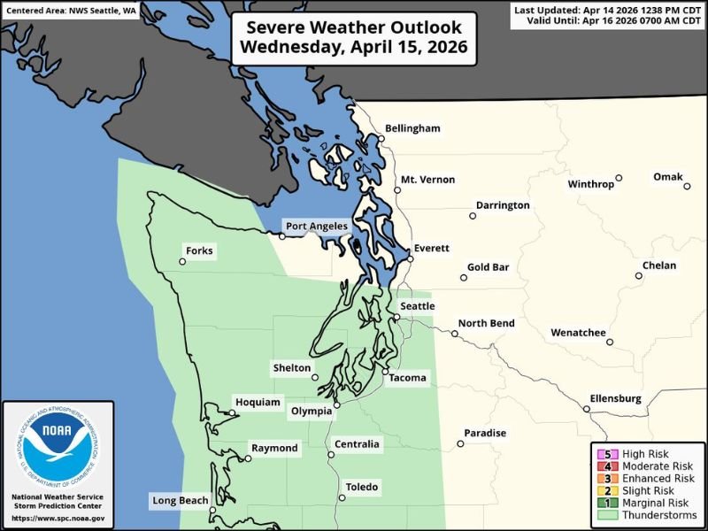
Cool air surging in behind Tuesday’s storm will destabilize the atmosphere, bringing a chance of scattered thunderstorms on Wednesday. The overall risk is considered low, with isolated storms most likely along the coast and from Seattle southward. The SPC Severe Weather Outlook has placed portions of Western Washington under a Marginal Risk, with a broader thunderstorm area extending from the coast through the south Sound. Any storms that develop could produce brief heavy rain, small hail, and lightning — though most of Wednesday is expected to remain dry with some sun breaks possible.
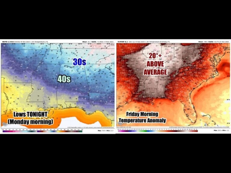
As skies clear Wednesday evening, temperatures are forecast to drop sharply. Thursday morning lows could dip into the mid-30s within city areas, with outlying regions south and east of Seattle potentially seeing freezing temperatures between 29 and 31 degrees. A similar frost or freeze risk is possible Friday morning, prompting concerns for sensitive plants and vegetation across the region. Sunny conditions are expected to dominate late in the week before clouds and showers return for the weekend.
Have you been impacted by the storms or high winds in Western Washington this week? Share your experience and stay connected with our latest weather coverage at SaludaStandard-Sentinel.com.