Tornado Alley Shifts North in June as Central and Northern Great Plains Become the Primary Severe Weather Target With Super High CAPE Values Expected
KANSAS CITY, MO — As the calendar turns to June, the heart of tornado and severe weather activity across the United States undergoes a well-documented climatological shift northward, with the Central and Northern Great Plains replacing the traditional southern plains as the primary tornado threat zone while longer days and intense daytime heating drive atmospheric instability to some of the highest values of the entire year.
Why Tornado Alley Moves North in June
The northward migration of tornado alley during June is driven by a fundamental shift in the position of the jet stream, which climatology strongly favors moving poleward and weakening during this period as the Northern Hemisphere transitions deeper into summer.
As the jet stream retreats northward, the primary corridor of wind shear and atmospheric energy that fuels organized supercell thunderstorm development follows, shifting the most favorable tornado environment away from Oklahoma and Texas and northward into Nebraska, Kansas, Iowa, Minnesota, and surrounding Northern Great Plains states where conditions become increasingly favorable for powerful storm development.
Super High CAPE Values Define June Storms
While June typically produces fewer tornadoes in raw numbers compared to May, the storms that do develop during this period can rank among the most powerful and visually spectacular of the entire severe weather season due to one critical atmospheric ingredient — extraordinarily high Convective Available Potential Energy values driven by the combination of extended daylight hours and intense daytime heating across the plains.
Super high CAPE values provide thunderstorms with enormous amounts of atmospheric fuel, allowing storm updrafts to reach exceptional strength and producing supercells capable of generating very large hail, destructive winds, and significant long track tornadoes when sufficient wind shear is present alongside the intense instability.
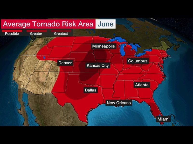
Average June Tornado Risk Covers Vast Territory
The average June tornado risk map depicts a sweeping and broad zone of elevated tornado potential covering an enormous portion of the central and eastern United States, with the greatest risk concentration centered across the central plains corridor spanning from Denver and Kansas City through Minneapolis and extending across a wide swath of the nation.
Communities across Nebraska, Kansas, Iowa, Missouri, Minnesota, Wisconsin, and extending eastward through Ohio and Indiana all fall within areas carrying meaningful average June tornado risk, reflecting the broad geographic footprint of the northward shifted severe weather pattern during this month.
Will June 2026 Deliver a Major Outbreak
With long range forecast guidance already signaling an increasingly active severe weather pattern across the central plains through the first half of June 2026, the climatological backdrop of northward shifted tornado alley and super high CAPE potential creates a setup that severe weather researchers and meteorologists are watching with considerable interest as the month gets underway.
For continuing coverage of tornado season developments and severe weather pattern analysis across the United States, visit SaludaStandard-Sentinel.com.