Spectacular Saturday and Dry Mothers Day Headline a Mostly Quiet Week Across Northern Illinois and Southern Wisconsin With Rain and Thunder Returning Monday Night Into Tuesday
NORTHERN ILLINOIS/SOUTHERN WISCONSIN — A mostly quiet and pleasant weather week is on tap for the Northern Illinois and Southern Wisconsin Stateline region through the May 8 to 14 forecast period, highlighted by a spectacular Saturday, a dry Mother’s Day Sunday, and just one meaningful rain chance arriving Monday night into Tuesday before warmer temperatures return by next weekend.
Friday Brings Warmth With Isolated Sprinkle Possible
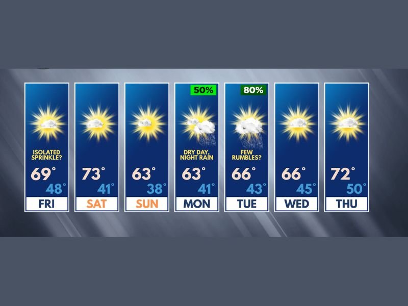
Temperatures are rising heading into the weekend with Friday delivering a seasonable high of 69 degrees beneath a good deal of sunshine. A few afternoon clouds may attempt to produce an isolated sprinkle, but any moisture will be minimal and inconsequential for the vast majority of the region. Overnight lows will drop to a comfortable 48 degrees as the pleasant pattern takes hold across the Stateline area.
Saturday the Clear Highlight of the Forecast Period
Saturday stands out as the week’s highlight, with temperatures climbing to a very pleasant 73 degrees under predominantly sunny skies. Rain chances have been completely removed from the Saturday forecast, delivering a day that forecasters describe as nothing short of spectacular for outdoor activities across the region. Overnight Saturday will see temperatures drop to 41 degrees heading into the Mother’s Day holiday.
Mother’s Day Dry but Cooler at 63 Degrees
Mother’s Day Sunday will bring cooler conditions with a high of 63 degrees, but rain chances have been fully pulled from the holiday forecast as well. The dry conditions represent a trade most families with outdoor Mother’s Day plans will accept without hesitation despite the cooler feel. Overnight lows Sunday will fall to 38 degrees, the coolest night of the entire forecast period.
Monday Night Into Tuesday Brings Rain and Thunder
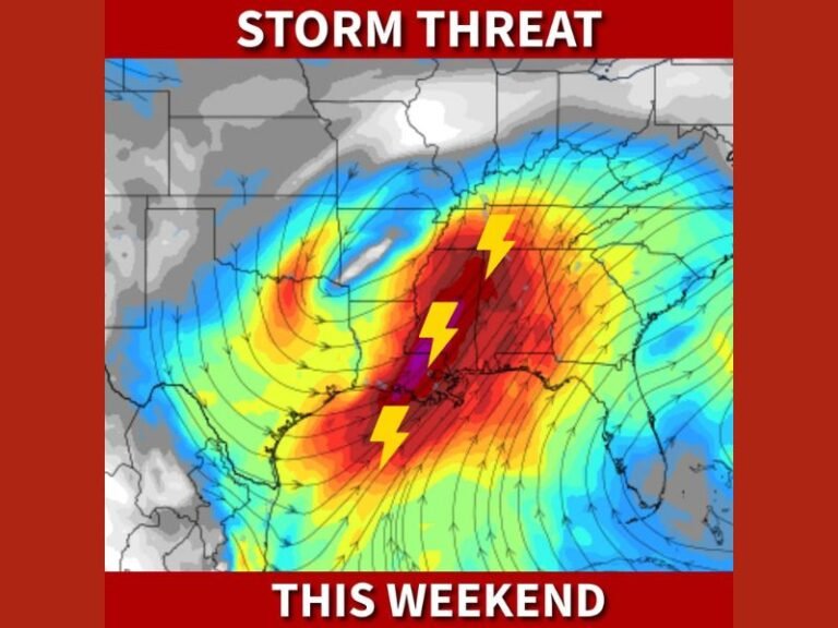
The week’s only significant rain chance arrives Monday night into Tuesday, with an 80 percent probability of showers and possible thunder by Tuesday. Forecasters confirm severe weather is not even a remote concern with this system. A pattern change then gets underway mid to late next week, with much warmer temperatures returning across the region by next weekend.
For continuing coverage of severe weather events and critical storm analysis across the United States, visit SaludaStandard-Sentinel.com.