Heavy Rain and Flash Flood Emergency Threatens Alabama on Wednesday With Severe Wind Gusts and Tornado Risk Focusing Near and South of I-20 After 7 PM and Rain Totals Reaching Up to 3.5 Inches
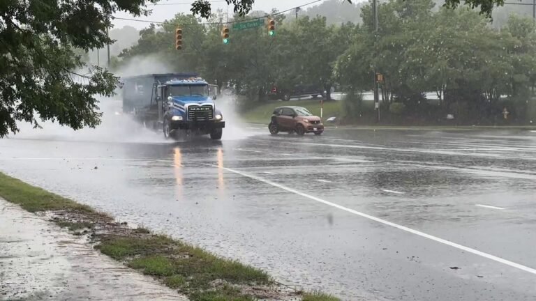
ALABAMA — The latest Tuesday evening forecast data continues to highlight two primary concerns for Alabama on Wednesday, with heavy rain and flash flooding standing as the dominant threat. A severe weather risk also requires close monitoring across the state, and forecasters are clear that residents must not let their guard down despite flooding being the headline story.
Flash Flooding Remains the Primary Concern Across Alabama
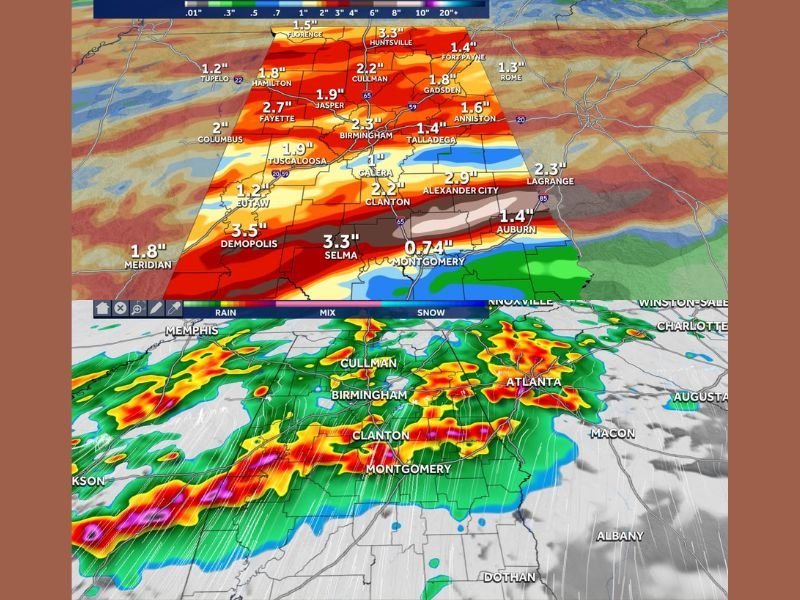
Forecast rain totals through Thursday 4 a.m. paint a significant picture across the state. Demopolis is projected to receive 3.5 inches, Selma and Huntsville both reaching 3.3 inches, Jasper at 2.7 inches, Fayette at 2.7 inches, and Birmingham coming in at 2.3 inches.
Rain Totals Signal Widespread Flooding Risk Statewide
Additional totals include Tuscaloosa at 1.9 inches, Gadsden at 1.8 inches, Cullman at 2.2 inches, and Montgomery at 0.74 inches. These accumulations are expected to overwhelm drainage systems and trigger localized flash flooding across multiple counties throughout the day and overnight.
Severe Storm Threat Concentrates South of I-20 After 7 PM
The most intense storms capable of producing high wind gusts and tornadoes are expected to focus near and south of Interstate 20 after 7 p.m. Wednesday. The latest HRRR guidance confirms this zone, with areas including Birmingham, Clanton, Selma, and Montgomery falling within the elevated risk corridor.
Futuretrack Radar Confirms Heavy Line Pushing Through Central Alabama
Futuretrack radar projections show a solid and organized line of heavy precipitation pushing through central and southern Alabama by 9 p.m. Wednesday. Alexander City, Clanton, and surrounding communities should remain on high alert as the evening storm line advances eastward through the night.
Residents Urged to Stay Alert and Ready to Take Shelter
Forecasters stress that while a high volume of severe reports is not expected, isolated storms capable of serious damage remain a real possibility. Residents across Alabama, particularly those south of I-20, are urged to monitor weather alerts closely and be ready to take shelter immediately when warnings are issued. For continuing coverage of severe weather events across the United States, visit SaludaStandard-Sentinel.com.