Enhanced Risk Severe Storms With 70 MPH Winds Large Hail and Isolated Tornadoes Strike North Texas and Southern Oklahoma Across Two Rounds Tuesday
DALLAS, TX — A significant two-round severe weather event was forecast to impact North Texas and Southern Oklahoma on Tuesday, with the first batch of storm activity targeting northern counties from Graham west to Paris east between 8 AM and noon, followed by a stronger and more intense second round carrying an Enhanced risk for severe storms across the Dallas metroplex from 5 PM through midnight.
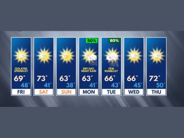
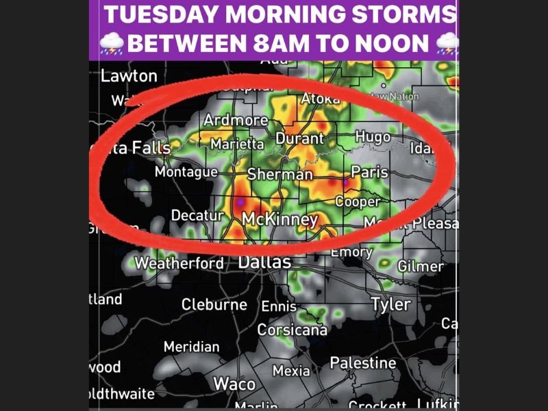
The first round was expected to push through northern counties including Sherman, Durant, Ardmore, McKinney, and Paris through the morning hours, bringing initial storm hazards before the atmosphere recovered into the mid to upper 80s through the late afternoon ahead of the more dangerous evening round.
Morning Round Targets Northern Counties First
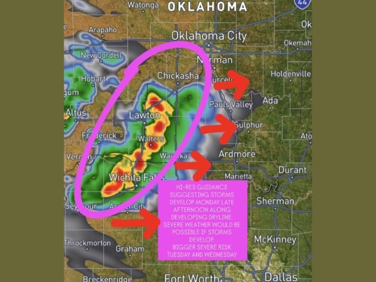
The first batch of storm activity was concentrated across the northern tier of the region, with radar imagery showing active precipitation cores centered across Sherman, Durant, Marietta, Ardmore, and Paris during the 8 AM to noon window. Communities from Graham in the west through Hugo and Paris in the east fell within the primary impact zone for the morning storm round.
While the morning round was the lesser of the two threats, storm activity across this corridor still carried the potential for localized hazards as cells pushed through the northern counties ahead of the midday clearing period.
Second Round Brings Enhanced Risk Through Evening
The second and significantly more dangerous round of storms was forecast to develop across the Dallas metroplex and surrounding region from 5 PM through midnight. With the atmosphere recharging into the mid to upper 80s through the afternoon, conditions were expected to become highly favorable for organized and intense storm development by early evening.
The Enhanced risk designation for the second round signaled a well above average probability of widespread severe weather, placing the Dallas area and surrounding communities on alert for the most significant storm hazards of the day.
70 MPH Winds Large Hail and Tornadoes on the Table
The second round severe weather hazard suite included damaging winds reaching up to 70 miles per hour, large to very large hail capable of causing significant damage to vehicles and property, and isolated tornadoes. Wind gusts of 70 miles per hour carry the capacity to down large trees, destroy outbuildings, and cause widespread power outages across a broad area.
Residents were specifically advised to park vehicles undercover if at all possible ahead of the evening storm round given the large to very large hail threat accompanying the Enhanced risk system.
Cold Front Clears the Region After Midnight
A cold front was expected to arrive after midnight and push the storm system out of the region, bringing an end to the severe weather threat through the overnight hours. Until that frontal passage, residents across North Texas and Southern Oklahoma were urged to remain weather aware through the full 5 PM to midnight window and have shelter plans ready for the stronger and more intense second round of Tuesday storms.
For continuing coverage of severe weather events and critical storm analysis across the United States, visit SaludaStandard-Sentinel.com.