Active Low Pressure System Spins Near Casper Wyoming Bringing Snow to Northern Mountains Hail Lightning and Funnel Cloud Reports Across Colorado’s Eastern Plains
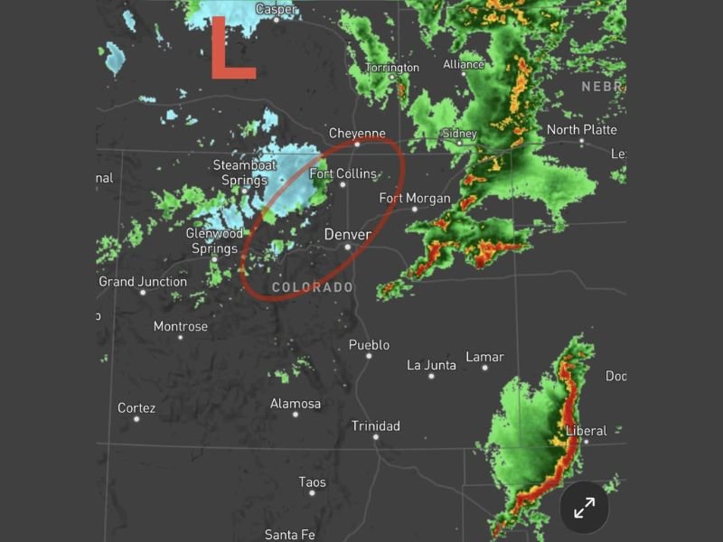
DENVER, CO — A center of low pressure spinning near Casper, Wyoming is driving an active and multi-hazard severe weather day across Colorado, with snow spreading across the northern mountains and higher elevations of the Medicine Bow and Laramie Range while clusters of strong thunderstorms continue across the eastern plains east of Interstate 25. The day has produced numerous hail reports, widespread lightning activity, several funnel cloud reports, and gustnado observations across the Colorado plains as the low pressure system continues its passage through the region.
Snow Spreads Across Northern Mountains While Thunderstorms Fire East of I-25
The low pressure center near Casper is simultaneously driving two distinct weather regimes across Colorado, with snow impacting the Medicine Bow and Laramie Range at higher elevations while intense thunderstorm activity dominates the eastern plains. Multiple lightning strikes were reported around Laramie within the past hour, while Sterling has experienced its third round of thunderstorms through the day, reflecting the persistent and repeated nature of storm activity across the northeastern Colorado plains.
The majority of the thunderstorm activity has remained east of I-25 as forecast, with only isolated cells developing closer to the Front Range through the day.
Hail Reports Funnel Clouds and Gustnadoes Documented Across the Eastern Plains
Thursday’s storm activity across Colorado’s eastern plains generated numerous hail reports, extensive lightning activity, and several funnel cloud observations across the region. Gustnadoes, which are brief whirlwinds formed along storm outflow boundaries that are commonly mistaken for tornadoes, were also reported at multiple locations across the plains during the day’s active storm period.
No tornado has been visually confirmed despite the funnel cloud reports, with forecasters noting the distinction between the confirmed gustnado activity and any potential supercell tornado development across the eastern Colorado corridor.
Overnight Storm Chances Continue North of Denver Before Spreading Southeast
As the low pressure center passes to the north overnight, additional showers and thunderstorms may develop mainly north of Denver, with activity potentially spreading southeast across the plains through the overnight hours. Rogue outflow boundaries from existing thunderstorms could also serve as triggers for additional storm development through the night, adding a degree of uncertainty to the overnight forecast that standard models typically struggle to resolve accurately.
Residents across the Denver metro, Fort Collins, and communities north and east of the city are encouraged to remain weather aware through the overnight hours as the low pressure system completes its passage and residual storm activity continues across the region.
For continuing coverage of severe weather events and storm tracking across the United States, visit SaludaStandard-Sentinel.com.