Light Snow Moves Across Western Illinois as Rain Shifts East Overnight
PEORIA, Ill. — Rain showers across central Illinois have transitioned to light snow west of the Illinois River, with flurries expected to continue shifting east through the early morning hours.
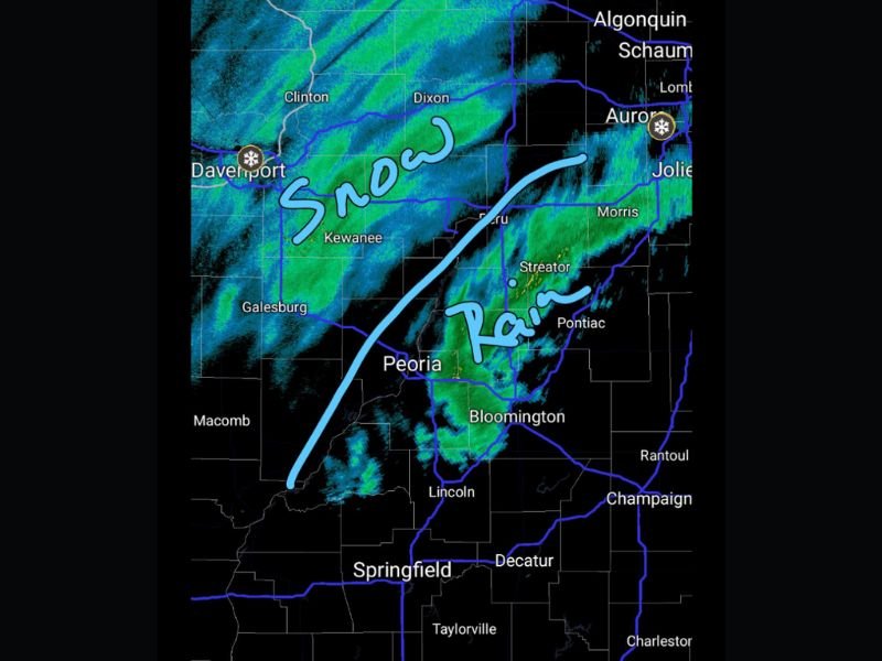
Meteorologist Chris Yates reported late Saturday night that precipitation began changing from rain to snow around Davenport, Galesburg, and Kewanee, before moving toward Peoria and Bloomington.
According to Yates, little to no accumulation is expected due to surface temperatures remaining above freezing. “The system is moving quickly, and any snow that falls is likely to melt on contact,” he said in his update posted around 12:10 a.m. Sunday, November 9.
Areas Seeing the Changeover
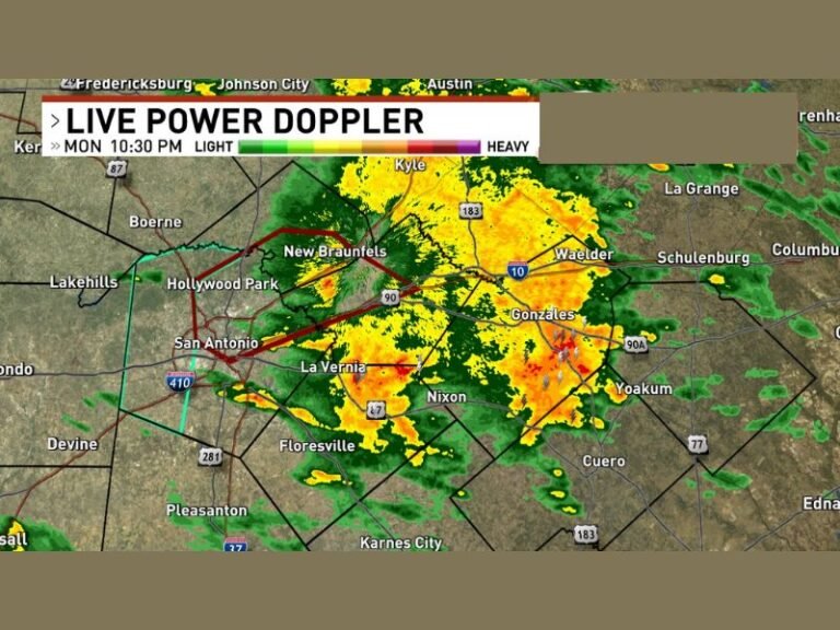
Radar imagery from the KDWN Quad Cities station showed a clear dividing line between rain and snow, stretching from Macomb to Kewanee and curving northeast toward Aurora. Areas east of that line, including Pontiac, Morris, and Joliet, continue to experience light rain.
By 4 a.m., the snow band is expected to push farther east, briefly brushing parts of Bloomington and Lincoln before tapering off completely.
Minimal Travel Impact Expected
Forecasters say travel conditions should remain manageable overnight, though drivers may notice brief bursts of heavy flakes west of Peoria and into the Quad Cities region. Road temperatures are not cold enough for widespread icing.
The quick-moving disturbance is part of a larger cold front sweeping across the Midwest, setting up a chillier start to the week for much of Illinois.
Residents can expect morning lows in the 30s, with highs Sunday only reaching the mid-40s under partly cloudy skies.
Stay up to date on Illinois weather alerts, forecasts, and winter safety news at SaludaStandard-Sentinel.com.