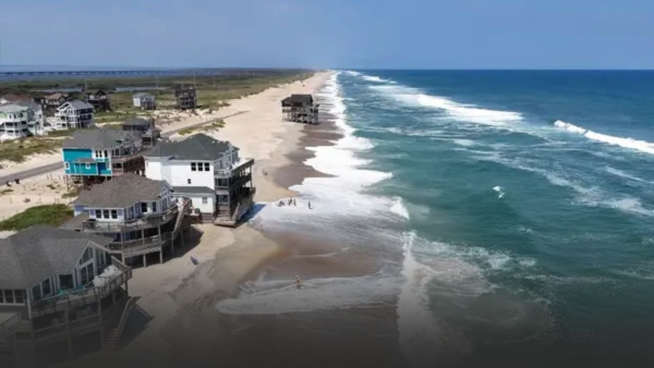
NC Outer Banks Braces for Coastal Flooding as Seas Rise and Winds Hit 50 mph
MOREHEAD CITY, N.C. — Residents across North Carolina’s Outer Banks are preparing for dangerous storm surge, high surf, and gusty winds as a weather system continues to impact the coast through Saturday morning. The National Weather Service in Newport/Morehead City has issued a storm surge warning stretching from East Carteret County to the Northern Outer Banks, including Ocracoke, Hatteras Island, Beaufort, Nags Head, and Rodanthe.
Rising Seas and Surge Threats
Surge levels are projected to reach 2 to 4 feet in low-lying areas, a height that could inundate marinas, roads, and shoreline homes. Officials warn that while widespread rain and tornadoes are not expected, the wave-driven surge and ongoing beach erosion present a serious hazard for coastal communities.
Emergency officials are urging residents to finalize preparations and remain alert to changing conditions. Any mandatory evacuation orders must be followed immediately, and those choosing to stay in flood-prone zones are being asked to shelter in place.
Gusty Winds and Power Concerns
While tropical-storm-force winds are not sustained, forecasters note that gusts could reach up to 50 mph on Hatteras and Ocracoke Islands. These conditions are sufficient to:
- Bring down tree limbs
- Knock out power in scattered communities
- Make bridges and elevated roads especially dangerous to drive on
Travel across major connectors, including Ocracoke-Hatteras ferry routes and bridges linking the islands, is expected to be hazardous through Saturday.
Flooding and Road Closures
Local emergency managers have already reported partial closures of coastal roads, particularly in areas prone to flooding during high tide. Authorities remind residents and visitors not to attempt driving through standing water, which can mask roadway damage and strong currents.
Unlike recent storms where heavy rainfall caused inland flooding, this event is primarily surge-driven, making low-lying and waterfront properties most vulnerable.
Community Impacts
- Marinas: Dockmasters have urged boat owners to secure vessels or move them inland.
- Tourism: Beach towns like Nags Head and Rodanthe have issued advisories warning visitors to avoid shorelines due to rip currents and erosion.
- Residents: Families are moving vehicles to higher ground and stocking essentials in case of extended power outages.
Forecast and Timeline
- Friday Night into Saturday Morning: Surge remains elevated, with gusty winds along the barrier islands.
- Saturday Afternoon: Conditions are expected to ease as winds diminish.
- Saturday Evening – Sunday: Warnings may be lifted, though rough surf and rip currents are expected to linger.
The storm system reinforces the vulnerability of North Carolina’s barrier islands, where even moderate tropical systems can disrupt daily life with surge, erosion, and dangerous surf. Officials continue to monitor the storm’s track and warn that advisories could change if the system shifts closer to shore.
Are you in the Outer Banks or nearby areas experiencing flooding or gusty winds? Share your updates in the comments on SaludaStandard-Sentinel.com.