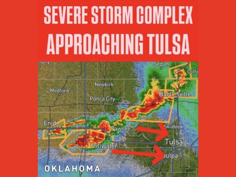
Hurricane Erin to Bring Big Waves Along East Coast; NC and VA Declare State of Emergency
NORTH CAROLINA – As Hurricane Erin continues tracking up the East Coast, states including North Carolina and Virginia are bracing for destructive surf, severe coastal flooding, and dangerous rip currents. Officials have issued emergency declarations, and popular beaches are being closed in anticipation of worsening conditions throughout the week.
State of Emergency Declared in North Carolina and Virginia
North Carolina Governor Roy Cooper and Virginia officials have both issued emergency declarations as Hurricane Erin’s projected path brings it closer to the southeastern coast. Although the hurricane is not forecast to make direct landfall in either state, its wide wind field and slow movement have raised serious concerns about coastal erosion and tidal flooding.
The storm’s outer bands are already being felt in portions of the Outer Banks, and warnings from the National Weather Service have prompted mandatory evacuation orders in multiple coastal counties, including Dare County, Hyde County, and Ocracoke Island.
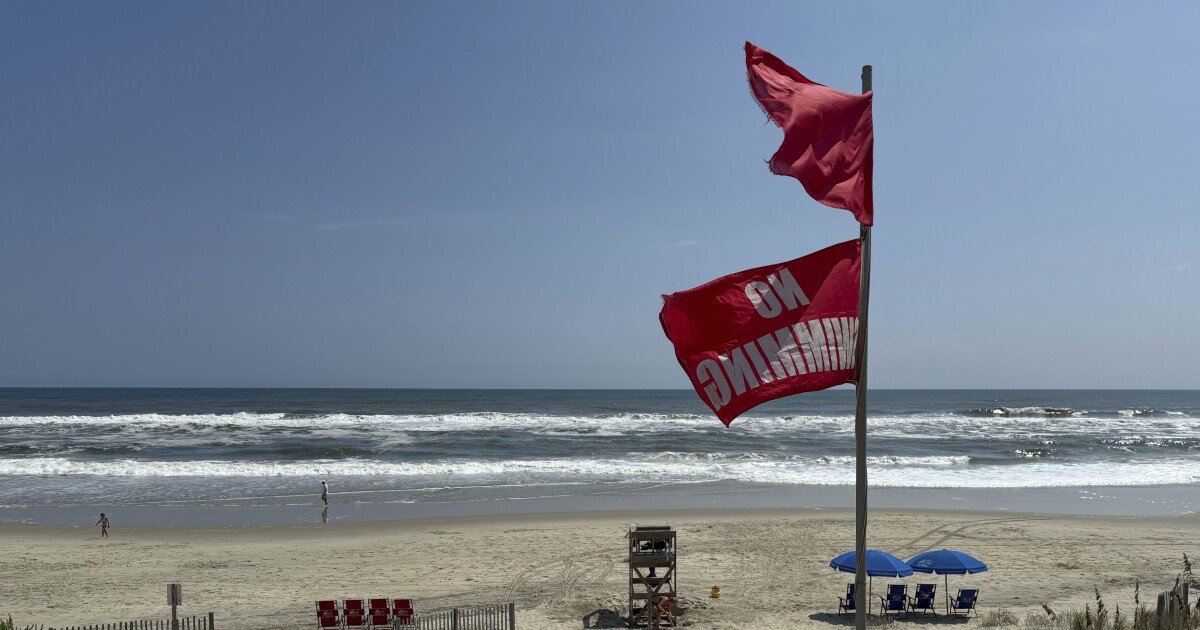
Waves Expected to Reach Over 10 Feet in Some Areas
According to meteorologists, the most significant danger may come from the sea itself. Hurricane Erin is churning up waves as high as 10 to 14 feet, which could hammer the Carolina coast through midweek. NC 12, a key transportation artery along the Outer Banks, is expected to experience overwash and may become impassable in certain stretches.
Beach communities from Nags Head to Hatteras Island are already seeing strong surf and the first signs of dune erosion. In Charleston, South Carolina, forecasters are warning of elevated tides that could cause urban flooding in low-lying areas, particularly during evening high tides.
Officials Warn of Rip Currents and Beach Closures
Officials are urging the public to stay out of the ocean, even in areas not under evacuation orders. Dangerous rip currents are expected up and down the Atlantic seaboard — including beaches in Georgia, the Carolinas, and parts of Virginia.
Several beaches have closed access altogether, including major stretches of the Cape Hatteras National Seashore. Lifeguards and emergency services are on alert as coastal towns prepare for potential search and rescue operations due to noncompliance with beach restrictions.
Storm Surges, Flooding, and Travel Hazards Through the Week
While Hurricane Erin is expected to remain offshore, its slow movement and massive wind field mean that storm surge and flooding may persist over several tide cycles. Emergency management agencies in both North Carolina and Virginia are urging residents to secure property, limit travel in coastal zones, and follow local advisories.
Communities across the Pamlico Sound, Albemarle Sound, and Cape Fear River Basin are at risk for flash flooding, especially as heavy rain is forecast to move inland. Roadways along rivers and marshes could become inundated, further straining emergency services.
N.C. DOT and Local Agencies on High Alert
North Carolina’s Department of Transportation has deployed crews to monitor vulnerable roads like NC Highway 12, which historically suffers major damage during hurricanes. Sandbags, flood barriers, and detour signage are being pre-staged in flood-prone zones, and ferries to Ocracoke Island have suspended service until further notice.
Concerned about local storm safety or evacuations near your area? Stay informed by following official alerts and discussing emergency preparedness with your family. For ongoing weather updates affecting South Carolina and the greater East Coast, visit SaludaStandard-Sentinel.com daily.