Hurricane Erin to Bring Erosion, Dangerous Surf and Waves Along NC Coast as State of Emergency Declared
RALEIGH, NORTH CAROLINA — As Hurricane Erin edges closer to the North Carolina coastline, officials are warning of significant erosion, dangerous surf, and flooding across key parts of the Outer Banks. A state of emergency has been declared in anticipation of the storm’s land impacts, with mandatory evacuations already ordered for Dare County, Ocracoke Island, and Hatteras Island.
Evacuations Ordered Across Key Coastal Areas
State and local emergency management leaders issued mandatory evacuation orders beginning Saturday for several high-risk barrier islands:
- Ocracoke Island (Hyde County): All visitors were told to evacuate by 12 p.m. Saturday, and residents by 9 a.m. Sunday.
- Dare County: Visitors to Hatteras Island were required to leave by 10 a.m. Sunday.
- Hatteras Island: Expected to bear the brunt of coastal flooding, surf damage, and road washouts.
Governor Roy Cooper signed the state of emergency executive order, enabling immediate access to response resources and federal aid should it become necessary. “We’re urging residents and tourists alike not to take any chances,” said Cooper. “These barrier islands are extremely vulnerable to hurricane-driven storm surge and erosion.”
NC Highway 12 Expected to Flood
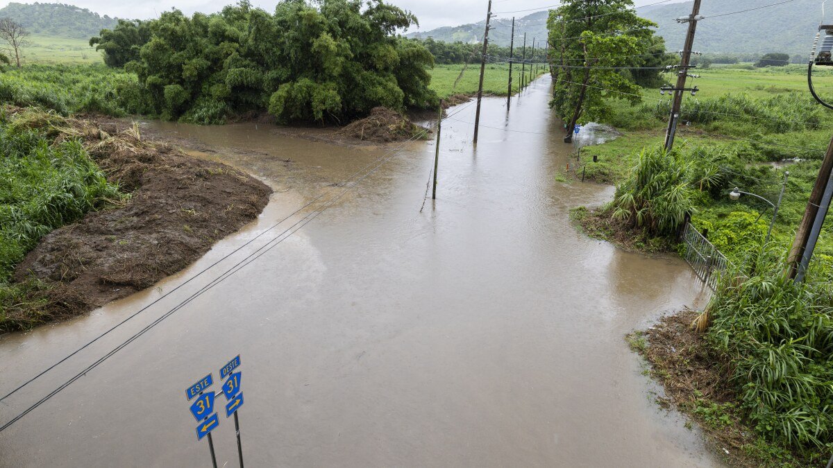
The North Carolina Department of Transportation warned that NC Highway 12, the only road connecting much of the Outer Banks, is likely to become impassable due to flooding and sand overwash.
The storm is expected to push heavy surf and 5- to 8-foot waves onto coastal roads, particularly during high tide cycles from Sunday night through Tuesday. “We anticipate multiple closures and possibly severe damage along NC 12,” the agency said.
Severe Coastal Impacts Anticipated
The National Hurricane Center reported that while Hurricane Erin is not forecast to make a direct landfall in North Carolina, the storm’s outer bands will still produce widespread coastal hazards, including:
- Beach erosion and dune loss
- Dangerous rip currents
- Strong wind gusts exceeding 50 mph
- Heavy rainfall and flash flooding in low-lying areas
In some areas, particularly Ocracoke and Hatteras, storm surge could exceed 3 feet, leading to saltwater intrusion and potential property damage.
Emergency Officials Urge Preparedness
The North Carolina Emergency Management (NCEM) is coordinating with local governments to deploy response assets, activate shelters, and monitor vulnerable populations. The American Red Cross has also pre-positioned supplies in inland counties.
Tourists are being asked to delay travel plans to the Outer Banks until after the storm passes and infrastructure assessments can be completed. Many ferry routes, including those to and from Ocracoke Island, have already been suspended.
“We don’t want to see rescues on the roads or in floodwaters,” NCEM Director Will Ray stated. “We’ve seen the devastation from storms like Dorian and Isaias, and this is shaping up to have similar impacts along the coast.”
Wave and Surf Conditions Already Worsening
As of Sunday morning, surf conditions were already deteriorating, with wave heights nearing 10 feet off the Cape Hatteras National Seashore. Several popular swimming beaches have posted red flags and no-entry warnings.
Ocean rescue crews have responded to dozens of calls in the last 24 hours, and multiple water rescues were reported on Saturday. Officials are pleading with visitors to stay off beaches and out of the surf until conditions improve.
Stay with SaludaStandard-Sentinel.com for continued updates on Hurricane Erin, emergency shelter information, and road closures across eastern North Carolina.