Tropical Trouble Spots to Watch From North Carolina as Atlantic Wave Tracks West
NORTH CAROLINA — The WXII 12 First Warning Weather Team is keeping a close eye on two tropical systems in the Atlantic this week, with one wave showing stronger potential for development as it tracks westward, according to WXII 12 News.
First Tropical Wave Struggles to Organize
Meteorologists say the first wave, located in the central Atlantic, is currently struggling to maintain organization due to surrounding dry air.
- Development likelihood: Low for the next 48 hours
- Potential changes: Gradual development possible early next week
- Impact: No expected threat to land at this time
This system is being closely watched, but experts emphasize it remains unlikely to pose hazards in the near term.
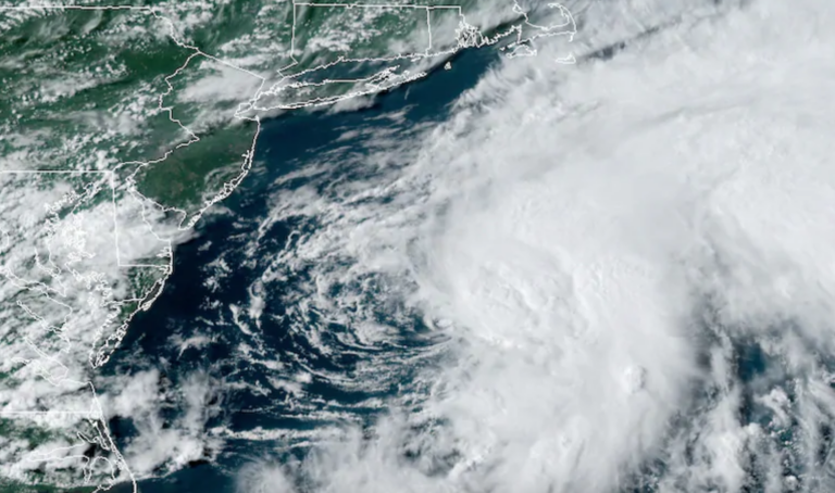
Second Wave Near Africa Could Become a Storm
The second tropical wave, located off the coast of Africa near the Cape Verde Islands, is showing a much higher probability of development. The National Hurricane Center reports it could become a tropical depression or storm within 48 hours.
- Organization: Large cluster of showers and thunderstorms
- Movement: West-northwest across the eastern and central tropical Atlantic
- Potential impact: May stay north of Antigua and the Caribbean Leeward Islands
If named, the storm would be called Erin, the next name on the 2025 Atlantic storm list.
2025 Atlantic Hurricane Season So Far
So far this season, there have been four named storms:
- Andrea
- Barry
- Chantal – brought devastating flash flooding to central North Carolina, killing five people over the July Fourth weekend before dissipating on July 6.
- Dexter – formed in early August
These early storms have set the tone for a season meteorologists say could be active and potentially dangerous.
Preparedness Remains Key
While North Carolina is not currently in the forecast cone for either system, forecasters stress the importance of monitoring updates during peak hurricane season. Tracking tools such as the WXII 12 Interactive Radar can help residents stay informed.
Have you prepared your household for hurricane season? Share your readiness tips or past experiences in the comments and join the discussion at SaludaStandard-Sentinel.com.