Strong Storms With Gustfront Frequent Lightning and Very Heavy Rain Push Into Denton and Collin County Texas Targeting Flower Mound and McKinney Monday
DENTON, TX — Strong thunderstorms pushed into Denton and Collin counties early Monday morning, with a well-defined gust front forming along the leading edge as the storm complex arrived with strong wind gusts, frequent lightning, and very heavy rainfall, directly targeting communities including Flower Mound, McKinney, and Carrollton as of the 5:55 AM radar update.
Gust Front Forms Along the Leading Edge
A gust front had developed along the leading edge of the advancing storm line as it pushed into Denton and Collin counties, a feature that typically signals the potential for sudden and dramatic wind increases as the storms arrive. This gust front was pushing southward toward Flower Mound and the northern suburbs of the Dallas-Fort Worth Metroplex, bringing the first burst of strong wind gusts ahead of the heaviest rainfall.
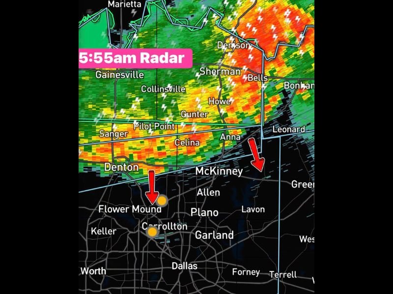
Radar imagery showed intense orange and red returns concentrated across the Denton County corridor, with the storm line extending from near Gainesville and Collinsville eastward through Sherman, Howe, and Bells as the system tracked southeast.
Frequent Lightning and Heavy Rain Accompany the Line
The storm complex was producing frequent lightning strikes across a broad area, with lightning indicators visible from Marietta and Gainesville southward through Celina, Anna, and McKinney. The heavy rainfall accompanying the line was capable of producing rapid water accumulation on roadways across Denton and Collin counties during the early morning commute hours.
Communities including Pilot Point, Sanger, Gunter, and Celina were all experiencing the storm activity as the line pushed southeast, with the heaviest cores tracked to arrive near Flower Mound and Carrollton within minutes of the radar update.
Northern Dallas Suburbs Directly in the Storm’s Path
McKinney and the surrounding Collin County communities were also squarely in the path of the advancing storm line, with radar returns showing the leading edge approaching from the north as of 5:55 AM. Areas including Allen, Plano, and Garland were positioned to see impacts shortly after as the line continued its southeastward progression.
Morning Commuters Urged to Use Caution
With the storm complex arriving during the heart of the morning commute, residents across Denton and Collin counties were urged to allow extra travel time, watch for ponding on roadways, and remain alert to rapidly changing conditions as the storms pushed through the northern Dallas-Fort Worth suburbs.
For continuing coverage of severe weather events and storm impacts across the United States, visit SaludaStandard-Sentinel.com.