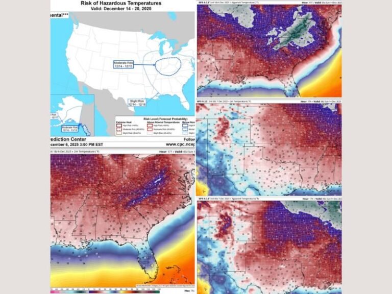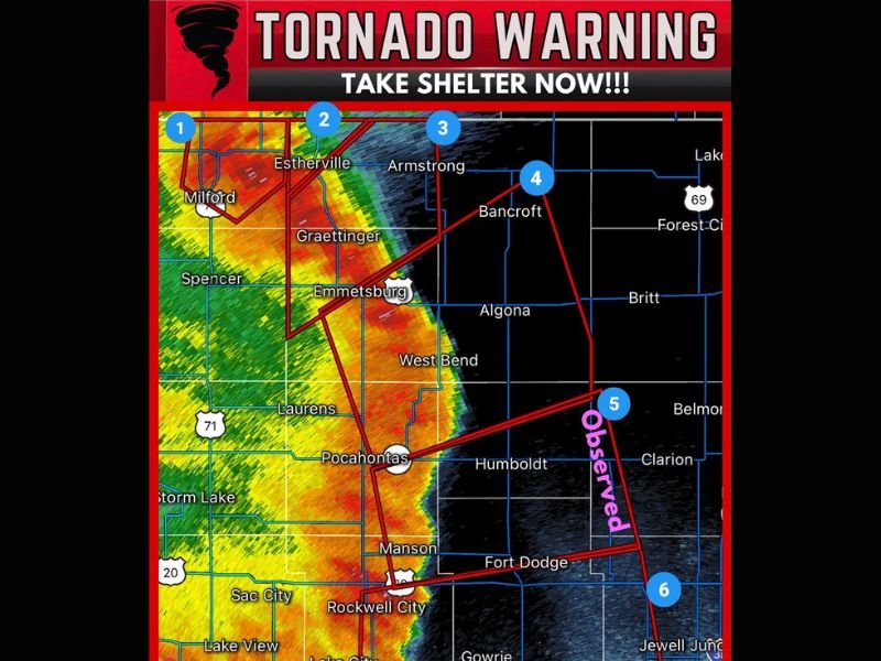
Multiple Tornado Warnings Issued Across Northwest Iowa as Six Simultaneous Severe Storms Including One Confirmed Tornado Threaten Communities From Spirit Lake to Rockwell City
FORT DODGE, IA — Multiple simultaneous tornado warnings have been issued across northwest Iowa as six separate severe thunderstorm events, including one confirmed tornado, threaten a broad corridor of communities stretching from Spirit Lake and Okoboji in the northwest southward through Estherville, Spencer, Pocahontas, and Rockwell City. The scale and simultaneous nature of this multi-warning event represents one of the most active and dangerous tornado warning situations to impact northwest Iowa during the current severe weather season.
Six Simultaneous Tornado Warnings Blanket Northwest Iowa Communities
A severe squall line capable of producing both tornadoes and extensive straight line wind damage was located over Okoboji and Spirit Lake, moving northeast at 30 miles per hour. Simultaneously, a separate severe thunderstorm capable of producing a tornado was located near Fort Defiance State Park, approximately 5 miles southwest of Estherville, moving northeast at 45 miles per hour. A third tornado capable storm was located near Dickens, about 7 miles southeast of Spencer in Clay County, moving northeast at 55 miles per hour.
A fourth severe thunderstorm capable of tornado production was located over Plover, approximately 10 miles northeast of Pocahontas, moving northeast at a rapid 60 miles per hour, further expanding the warning coverage across the region.
Confirmed Tornado Observed Near Pomeroy Moving East at 60 MPH
Among the six active warning situations, a confirmed tornado was observed over Pomeroy, located approximately 10 miles north of Rockwell City, moving east at 60 miles per hour. The confirmed tornado designation elevates this particular storm to the highest level of immediate danger within the overall warning complex, as an actual tornado on the ground moving at 60 miles per hour leaves residents in its path with very little time to reach adequate shelter before impact.
A sixth severe thunderstorm capable of producing a tornado was simultaneously located over Rockwell City Municipal Airport, moving east at 45 miles per hour, adding yet another layer of danger to an already extraordinarily active tornado warning situation across the northwest Iowa corridor.
Residents Across the Entire Warning Zone Must Take Shelter Immediately
The simultaneous nature of six active tornado warning situations across northwest Iowa demands immediate and urgent shelter action from all residents within any of the outlined warning polygons. Communities including Estherville, Spencer, Emmetsburg, Algona, Pocahontas, Humboldt, Fort Dodge, Rockwell City, and all surrounding areas must treat this event with the highest possible level of urgency and move to interior shelter locations immediately without delay.
The rapid forward speeds of multiple storms within this warning complex, with several cells moving at 55 to 60 miles per hour, means the window between warning issuance and storm arrival is extremely compressed across all affected communities throughout northwest Iowa.
For continuing coverage of tornado warnings and severe weather emergencies across the United States, visit SaludaStandard-Sentinel.com.