Southeast States Including Georgia, Alabama, Tennessee and Carolinas Face Below Normal Rainfall as 8–14 Day Outlook Signals Dry Pattern Shift
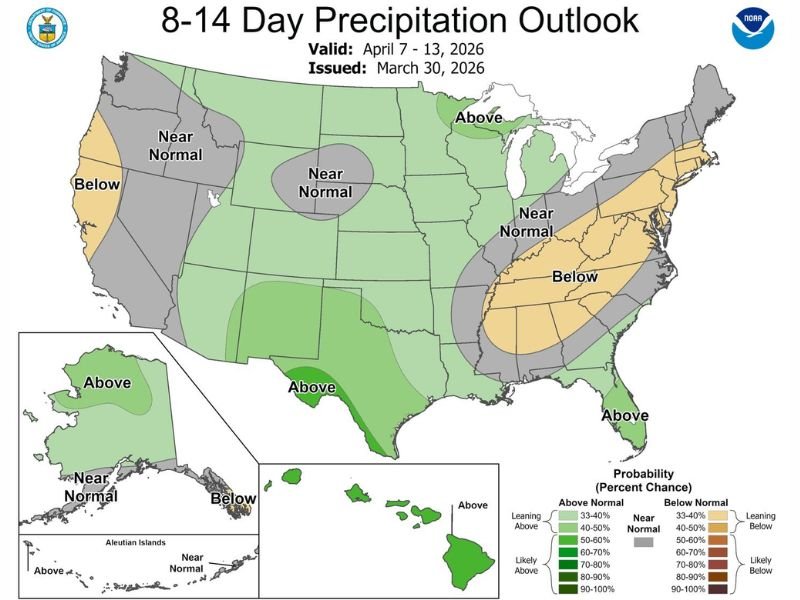
UNITED STATES — A noticeable shift in the weather pattern is now taking shape across the country, with the latest 8–14 day precipitation outlook pointing toward drier-than-normal conditions across much of the Southeast, raising concerns after earlier expectations for more rainfall.
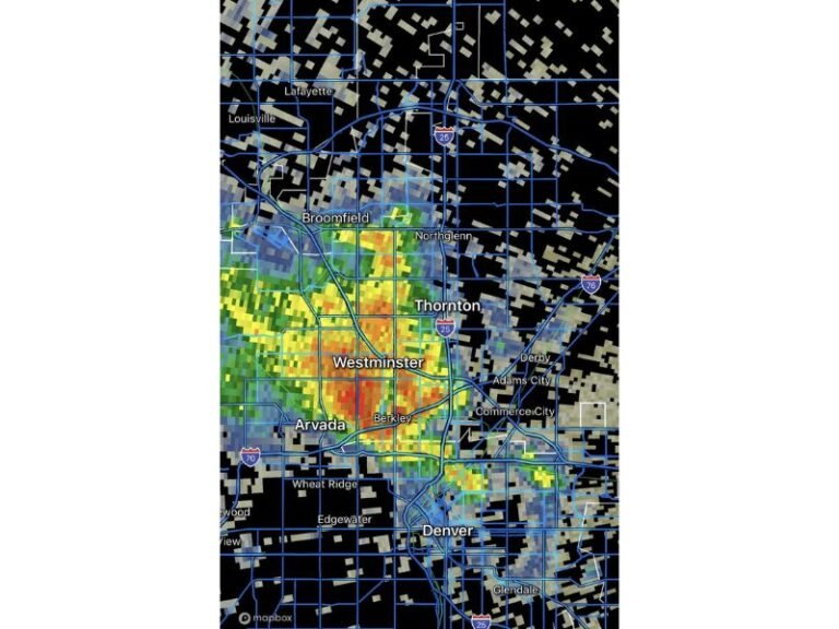
Forecast guidance shows that rain chances have significantly dropped off heading into early April, with only isolated showers expected through much of the week.
Forecast Models Shift Toward Drier Pattern Across Southeast
The latest outlook indicates below normal precipitation stretching across a large portion of the Southeast, including Georgia, Alabama, Tennessee, and the Carolinas. This marks a clear reversal from earlier expectations that suggested more widespread rainfall.
Meteorologists note that this kind of shift is not uncommon, but the consistency across multiple forecast models now supports a more stable, drier pattern taking hold.
Limited Rainfall Expected Through the Week
Rain chances throughout the week now appear minimal, with only scattered or isolated showers possible on most days. These brief rain events are unlikely to produce meaningful accumulation, especially in areas already trending dry.
Sunday currently stands out as the best opportunity for more organized rainfall, but even that system may not deliver widespread totals across the region.
Central and Northern U.S. Closer to Normal Conditions
While the Southeast trends dry, much of the central United States is expected to see near-normal precipitation levels, with some areas of the Upper Midwest even leaning slightly above normal.
This contrast highlights a split weather pattern, where storm systems are tracking away from the Southeast and focusing more toward northern regions.
Western U.S. Also Sees Mixed Signals
Parts of the West Coast, particularly California, are also expected to experience below normal rainfall, continuing ongoing concerns about limited precipitation in key areas.
Meanwhile, sections of the Pacific Northwest and interior West are forecast to remain closer to normal, indicating a more balanced pattern compared to the Southeast.
What This Means Going Forward
The developing dry stretch could begin to impact soil moisture levels, especially if the pattern persists beyond this outlook period. While not immediately alarming, the trend is something forecasters will continue to monitor closely.
Small changes in storm tracks over the coming days could still influence rainfall distribution, but for now, the signal clearly favors a quieter and drier setup across much of the Southeast. Readers are encouraged to share how conditions are shaping up in their area by visiting SaludaStandard-Sentinel.com.