North Carolina Storms Push South Overnight Bringing Heavy Rain Bands From Greensboro to Raleigh and Cooler Air Into Fayetteville
NORTH CAROLINA — Scattered showers and isolated thunderstorms are continuing to push south across the state Friday night, delivering much-needed rainfall to several regions while signaling a shift to cooler conditions overnight.
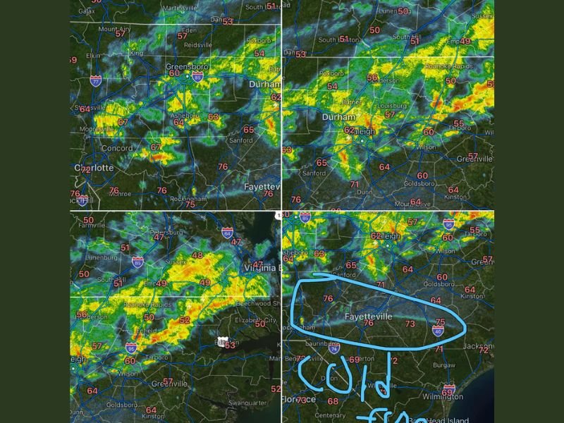
Radar imagery shows bands of moderate to heavy rain stretching from the Triad region through the Triangle and gradually sliding toward southern counties, including areas near Fayetteville, as a cold front progresses southward.
Rain Bands Move From Triad Through Triangle Regions
The heaviest activity earlier in the evening developed across central North Carolina, with notable rainfall impacting areas around Greensboro, Durham, and Raleigh. These rain bands brought steady showers and occasional heavier bursts, helping to soak dry ground across the region.
As the system continues to shift south, communities across the Sandhills and southern counties are now seeing increasing cloud cover and approaching rainfall. The movement has been steady, with storms gradually weakening but still capable of producing brief downpours.
Temperatures across central parts of the state have remained mild during rainfall, generally in the 50s and 60s, before cooler air begins to filter in.
Fayetteville and Southern Counties Next in Line
Forecast trends show the rain continuing its southward push overnight, with areas such as Fayetteville, Laurinburg, and surrounding communities expected to see showers late into the night and early Saturday morning.
While the intensity of storms may decrease compared to earlier activity farther north, steady rain is still likely in these regions. This could provide beneficial moisture for areas that have experienced drier conditions in recent weeks. Residents in southern North Carolina are advised to expect wet roads and reduced visibility during overnight travel.
Cold Front Brings Cooler Temperatures Behind the Rain
Following the passage of the rain bands, a cooler air mass is expected to settle into the state by early Saturday. This will bring a noticeable drop in temperatures compared to the mild conditions experienced earlier in the day.
The cooler air will also help stabilize the atmosphere, reducing the chance of additional thunderstorm development as the system moves farther south. By Saturday morning, much of central and northern North Carolina will begin to dry out, while southern areas may still see lingering showers.
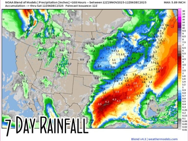
Much-Needed Rainfall Provides Relief in Some Areas
Meteorologists note that the rainfall associated with this system is beneficial, especially in areas that have been dealing with dry conditions. While not excessive, the steady nature of the rain allows for better ground absorption.
Localized heavier pockets may have occurred where stronger bands passed through, but widespread flooding is not expected. This event highlights a typical springtime pattern where fast-moving systems bring quick bursts of rain followed by cooler, drier air.
Conditions Improve Gradually Into Saturday
As the cold front clears the region, skies are expected to gradually improve from north to south. Saturday will begin with cooler temperatures and lingering clouds in southern areas, but overall conditions should trend drier through the day.
The system’s departure marks a transition toward more stable weather, at least temporarily, before the next potential system develops later in the pattern.
Have you seen the rain move through your area tonight or noticed the temperature drop? Share your local conditions and updates with us at SaludaStandard-Sentinel.com.