Tornado Warning in Tennessee as Dangerous Storm Near Pulaski Races Toward Lewisburg and the I-65 Corridor at 60 MPH
TENNESSEE — A tornado warning has been issued across parts of southern Middle Tennessee as a dangerous severe thunderstorm capable of producing a tornado races across the region late tonight.
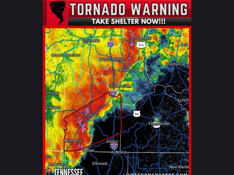
Meteorologists report the storm was located about eight miles southwest of Pulaski, Tennessee, and is moving northeast at nearly 60 miles per hour, creating an urgent situation for communities along its projected path. Officials are urging residents to take shelter immediately as the fast-moving storm approaches populated areas across the region.
Storm Moving Toward Lewisburg and the I-65 Corridor
Radar imagery shows a powerful severe thunderstorm tracking directly toward Pulaski, Cornersville, and Lewisburg, with the storm likely to follow a path close to the Interstate 65 corridor.
Communities that may be impacted include:
- Pulaski
- Minor Hill
- Cornersville
- Lewisburg
- Bryant Station
- Areas south of Columbia
Because the storm is moving quickly, conditions can worsen rapidly as it moves northeast across the area.
Tornado-Capable Storm Detected on Radar
Weather radar indicates strong rotation within the thunderstorm, a sign that the system could produce a tornado at any time.
Storms like this are also capable of producing:
- Damaging wind gusts over 60 mph
- Large hail
- Frequent lightning
- Heavy rain that sharply reduces visibility
Meteorologists say storms moving this fast can produce sudden dangerous conditions with very little warning.
Residents Urged to Take Shelter Immediately
Emergency officials emphasize that residents in the warning area should take shelter now rather than waiting to confirm a tornado visually.
The safest place during a tornado warning includes:
- A basement if available
- A small interior room on the lowest floor
- Areas away from windows and exterior walls
Mobile homes and vehicles provide little protection during tornadoes, and residents in those situations should move to stronger shelter immediately.
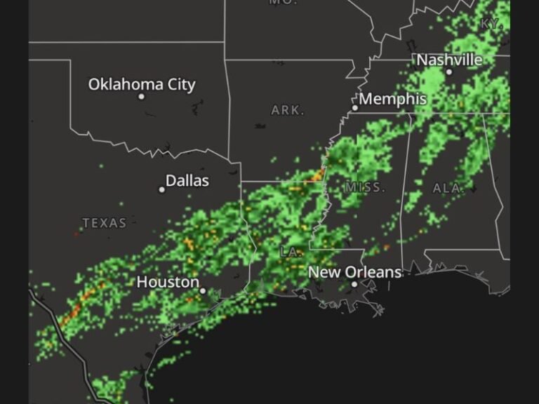
Storm Part of Larger Severe Weather Threat
The tornado-warned storm is part of a larger severe weather system impacting parts of the Southeast, capable of producing damaging winds, heavy rain, and isolated tornadoes. Meteorologists warn that nighttime storms can be particularly dangerous because tornadoes are harder to see after dark.
Residents across Middle Tennessee are encouraged to keep weather alerts active and monitor local forecasts closely as the storm continues moving northeast. Stay with SaludaStandard-Sentinel.com for continued updates as meteorologists track this dangerous storm across Tennessee.