North Carolina and South Carolina Face Rare March Weather Split as Tornado Threat Targets Eastern Areas While Snow Moves Into Western Mountains
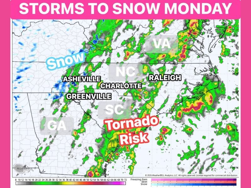
NORTH CAROLINA — A dramatic March weather pattern could bring two completely different types of dangerous weather to the Carolinas early next week. Forecasters say severe storms capable of producing tornadoes may develop across the eastern parts of the region, while colder air moving into the western mountains could allow snow to fall at the same time.
Meteorologists describe the situation as a classic early spring setup in the Southeast, where warm, unstable air collides with a surge of colder air moving in from the west. The result could create a sharp contrast in weather conditions across North Carolina and South Carolina.
Severe Storms and Tornado Risk Across Eastern Carolinas
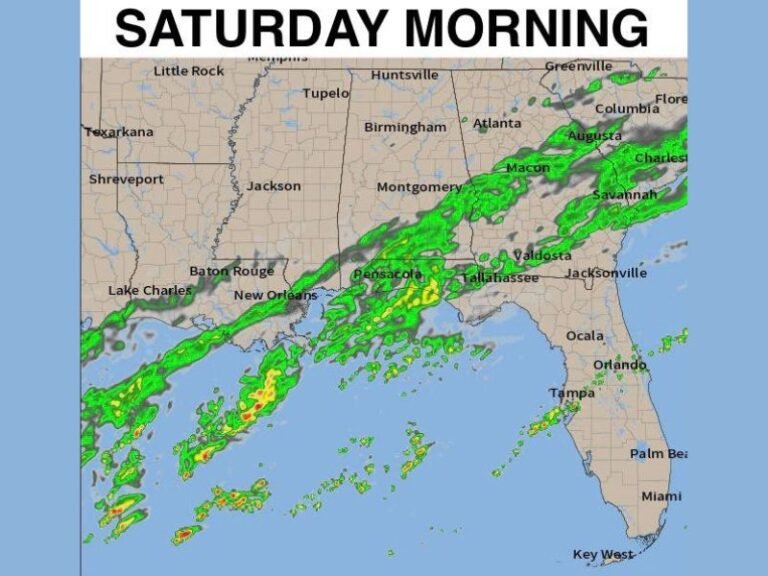
Weather models suggest the greatest threat for severe thunderstorms will develop across eastern sections of North Carolina and South Carolina, where warm, humid air is expected to fuel strong storm development. Cities including Raleigh and coastal areas of eastern North Carolina could see clusters of thunderstorms capable of producing damaging winds, heavy rainfall, and possibly tornadoes.
Storm activity may begin to intensify as a strong weather system moves across the Southeast, creating an environment supportive of rotating thunderstorms. Forecasters say the evolving setup will need to be monitored closely as it could produce significant impacts if storms organize into stronger lines or supercells.
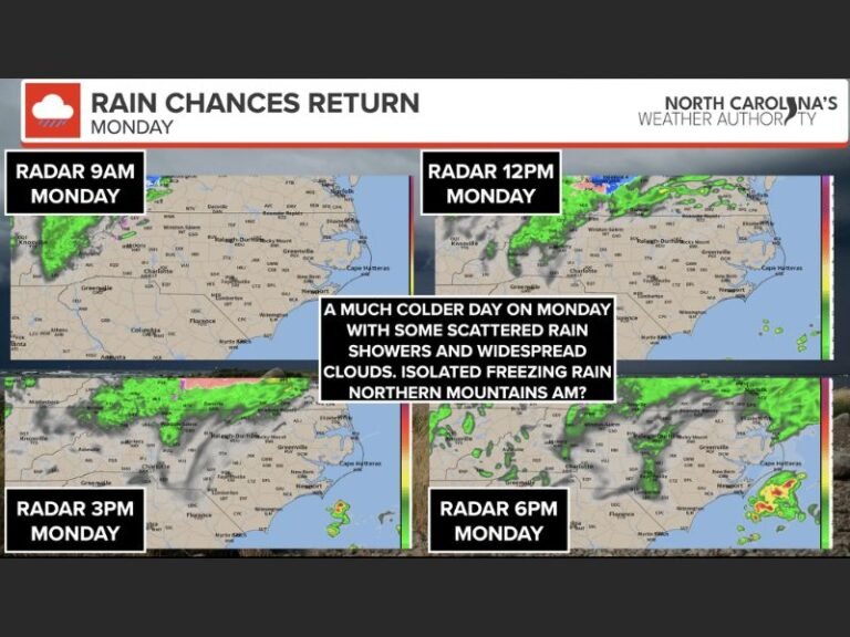
Colder Air Could Bring Snow to Western North Carolina
While severe storms threaten eastern areas, the situation will look very different across the mountains of western North Carolina. Cold air arriving behind the storm system may allow precipitation to change to snow in higher elevations, particularly near Asheville and the surrounding Appalachian mountain region.
Snowfall totals remain uncertain, but forecasters say the colder air moving into the western Carolinas could create conditions supportive of snow showers or brief accumulations in elevated areas. This sharp contrast between severe storms and snow occurring within the same region highlights how volatile March weather can be in the Southeast.
A Classic March Weather Setup in the Southeast
Meteorologists say the developing pattern is typical for early spring across the Carolinas, when winter and spring air masses frequently clash.
Warm air from the Gulf of Mexico often fuels severe thunderstorms across the coastal plain and eastern Piedmont, while colder air wrapping into the back side of the system can bring winter-like weather to higher elevations. When these two environments exist simultaneously, communities separated by only a few hundred miles can experience drastically different conditions.
Forecast Still Developing Across the Region
Weather experts emphasize that the exact timing and intensity of both the storm threat and potential snowfall will become clearer as newer forecast data arrives. Because the system could produce severe weather across parts of the Southeast, residents across North Carolina and South Carolina are encouraged to monitor updated forecasts closely over the next several days.
The developing setup has the potential to bring strong storms, heavy rain, and isolated tornadoes to eastern areas while mountain communities could see a brief return of winter weather. Readers across the Carolinas who experience unusual weather conditions are encouraged to share their reports and photos with the community at SaludaStandard-Sentinel.com.