Powerful Windstorm Targeting Washington Coast and Puget Sound With 55–60 MPH Gusts While Mountain Blizzard Closes Snoqualmie Pass
WASHINGTON — A powerful windstorm is expected to intensify across western Washington Wednesday evening, with forecasters warning that gusts between 45 and 60 mph could impact coastal communities, the Puget Sound region, and nearby counties as a cold front sweeps through the area.
Weather analysts say the winds are expected to increase rapidly between roughly 4 p.m. and 5 p.m., continuing well past sunset as the storm system strengthens. Early reports already indicate strong gusts, with Hoquiam recording a wind gust reaching 55 mph by 2 p.m., signaling that the system is beginning to ramp up across parts of the state.
The developing windstorm is being driven by a surge of strong westerly winds that will push across the Strait of Juan de Fuca and into the Puget Sound region later in the evening.
Coastal Areas and Islands Face the Strongest Winds
Forecasters say the most intense winds are expected along the Washington coast and across island communities where the incoming westerly surge will be strongest.
Wind gusts between 50 and 55 mph are forecast across areas including Whidbey Island, Camano Island, and the San Juan Islands as the strong winds move inland from the Pacific Ocean. In some locations, isolated gusts could briefly reach 60 mph as the surge pushes through.
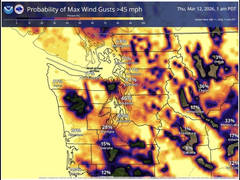
The same wind system will also spread into western Skagit County and Snohomish County, though winds in these areas may be slightly weaker, generally ranging between 40 and 50 mph.
Communities such as Everett, Arlington, and Mount Vernon have a high probability of experiencing gusts above 45 mph overnight.
Converging Wind Patterns Could Create Calm Corridor
Despite the overall strong wind pattern, meteorologists say an unusual feature could develop across parts of the North Puget Sound region.
Areas near Edmonds and Shoreline may temporarily experience calmer conditions as winds from different directions collide and partially cancel each other out. This convergence zone can create a narrow stripe where wind speeds drop while rainfall increases. Later in the evening, this collision of air flows could also trigger additional rain bands as the atmospheric boundary strengthens across the region.
Blizzard Conditions in the Cascades
While coastal communities deal with powerful winds, the situation in the Cascade Mountains is expected to become even more severe.
Heavy snowfall combined with strong winds is likely to create blizzard conditions across higher elevations. Transportation officials have already closed Snoqualmie Pass Wednesday afternoon due to the dangerous conditions.
Stevens Pass remains open but requires chains for vehicles as snow continues to accumulate. Mountain travel is expected to remain hazardous through the night as the storm system continues moving across the Pacific Northwest.
Windstorm Expected to Continue Overnight
Forecast maps indicate a high probability of wind gusts exceeding 45 mph across much of western Washington overnight. Some coastal locations have nearly certain chances of seeing strong winds as the storm reaches peak intensity.
Meteorologists say the overall forecast remains on track, with winds expected to remain strong into the late evening before gradually weakening early Thursday morning.
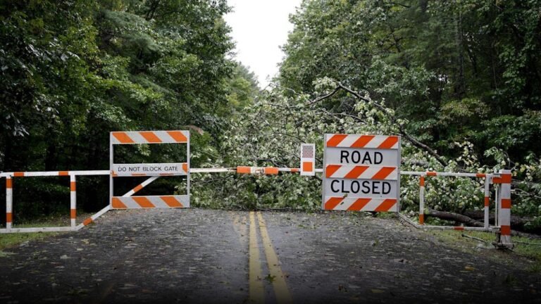
Residents across coastal Washington and the Puget Sound region are advised to secure loose outdoor items and remain cautious while traveling as strong winds could down tree branches or cause localized power outages.
Readers experiencing strong winds or storm impacts in their communities can share their reports and follow ongoing weather updates at SaludaStandard-Sentinel.com.