Expanding Winter Storm Threat From St. Louis to Boston as Southward Shift Raises Snow and Ice Risks Sunday Through Tuesday
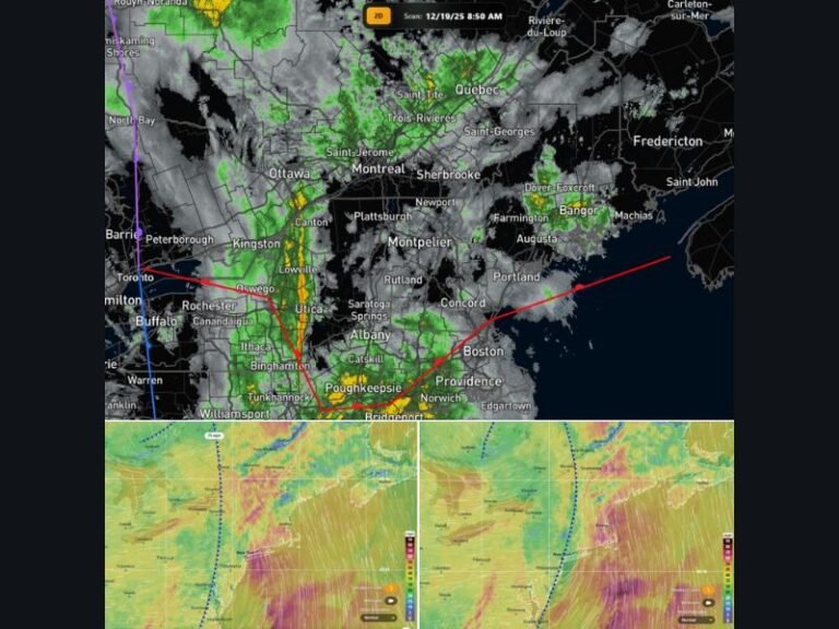
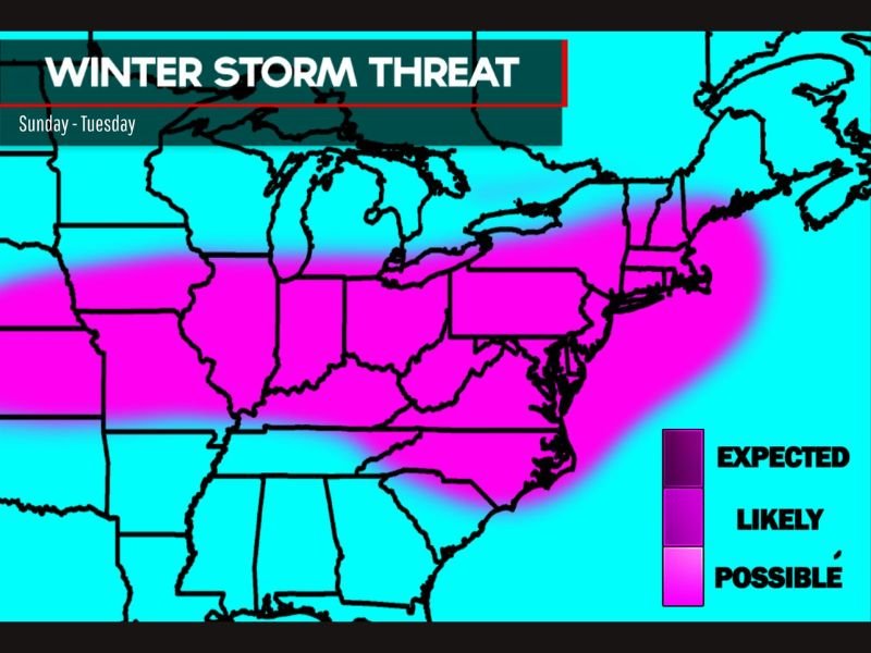
UNITED STATES — Confidence is increasing that a winter storm will impact a large stretch of the Ohio Valley, Mid-Atlantic and Northeast from Sunday through Tuesday, with accumulating snow and pockets of icing becoming more likely as the storm track shifts farther south.
Forecast guidance now shows a broader swath of potential winter weather impacts compared to previous outlooks, expanding the zone that could see accumulating snowfall and icy conditions.
Storm Track Shifts South, Expanding Impact Zone
Meteorologists note that compared to earlier projections, the system’s track has edged southward. That subtle shift has widened the area that may experience winter weather impacts.
The corridor most likely to see accumulating snow and ice stretches from:
- St. Louis
- Louisville
- Cincinnati
- Columbus
- Charleston
- Washington, D.C.
- Baltimore
- Philadelphia
- New York City
- Boston
While snowfall amounts remain uncertain, several inches of accumulation are possible in parts of this zone.
Snow and Ice Both Possible
In addition to snowfall, some areas could see ice accumulation, especially where surface temperatures hover near freezing while warmer air moves overhead.
Even modest icing can create:
- Slick road conditions
- Travel delays
- Isolated power outages
The risk appears greatest along the central portion of the storm track where temperature gradients may be sharp.
Not a High-End Event — But Disruptive
At this time, forecasters emphasize that the system does not appear to be a crippling or historic storm. However, even a moderate winter event spanning multiple states can lead to significant travel disruptions.
Air travel across major hubs in the Midwest and Northeast could be impacted, and ground travel may become hazardous during peak snowfall periods.
Forecast Refinement Ongoing
Details regarding exact snowfall totals, ice amounts and timing will continue to evolve over the next 24 to 48 hours.
Small adjustments in storm track or temperature profiles could shift the heaviest snow band north or south, altering impacts for major metro areas.
Residents across the Ohio Valley and Northeast are encouraged to monitor updated forecasts and prepare for possible travel delays early next week.
As the system approaches, confidence in specific impacts will improve.
Stay tuned for continuing updates as this developing winter storm takes shape across a wide stretch of the country. Follow the latest coverage at SaludaStandard-Sentinel.com.