Strong Thunderstorms Form Across North Georgia Bringing 40 MPH Wind Gusts, Quarter-Size Hail, Lightning and Heavy Rain Toward the Northeast
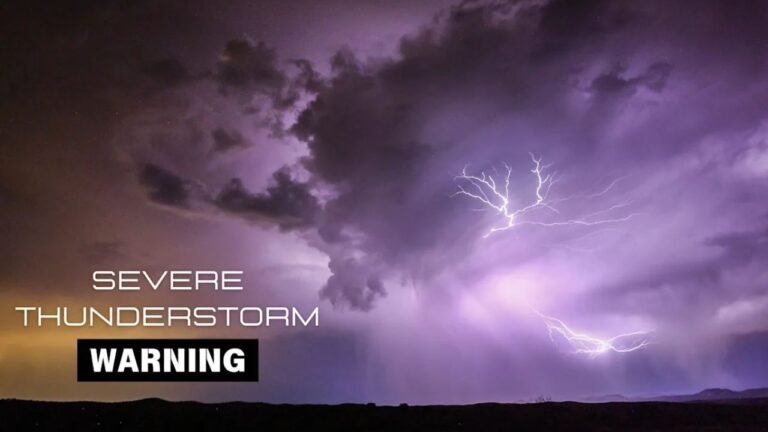
NORTH GEORGIA — Meteorologists are monitoring strong thunderstorms developing across parts of north Georgia, where several storm cells are already producing gusty winds, hail, and heavy rain as they move toward the northeast.
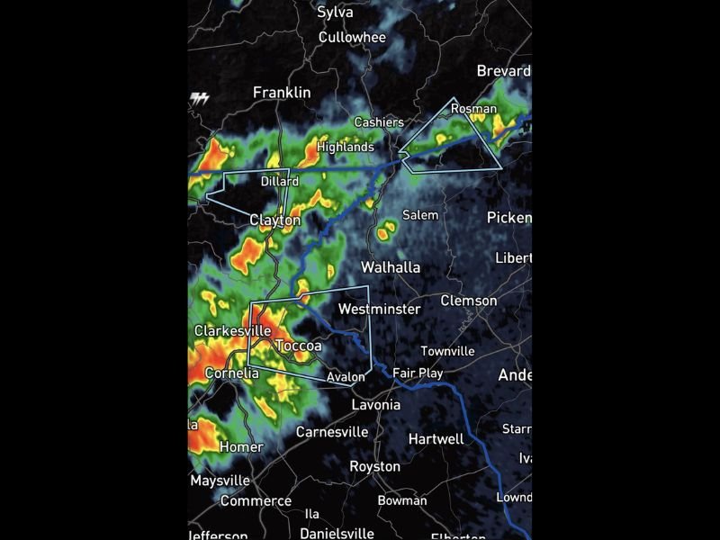
Radar imagery shows clusters of thunderstorms stretching across communities including Cornelia, Toccoa, Clarkesville, Clayton, Highlands, and Rosman, with the storms gradually tracking toward portions of the Georgia-North Carolina border region.
Weather experts say some of the stronger storm cells are capable of producing wind gusts up to 40 miles per hour along with quarter-inch hail, frequent lightning, and bursts of heavy rainfall.
Storm Cells Intensifying Across Northeast Georgia
The most intense thunderstorms appear concentrated around Cornelia, Toccoa, Clarkesville, and Clayton, where radar shows stronger storm cores embedded within the larger cluster of rain showers.
These storms are forming in a narrow corridor stretching toward the mountains of northeast Georgia and western North Carolina, including areas near Highlands and Cashiers.
As the storms continue moving northeast, additional communities in their path could experience brief periods of heavy rain and lightning.
Hail, Wind and Lightning Possible With Stronger Cells
Meteorologists warn that some of the storms currently forming in the region may produce wind gusts near 40 mph, which can knock down small tree branches and create difficult driving conditions.
The storms are also capable of producing small hail around the size of a quarter, along with frequent lightning strikes.
Lightning remains one of the most dangerous threats associated with these storms, especially for people outdoors in mountainous areas where storms can intensify quickly.
Heavy Rainfall Could Reduce Visibility on Roads
Along with wind and hail, the thunderstorms are producing brief bursts of heavy rainfall, which may reduce visibility on roadways across northeast Georgia.
Drivers traveling through areas such as Toccoa, Cornelia, Clayton, and Highlands could encounter rapidly changing conditions as the storm cells pass through.
Although the storms are not currently classified as severe, meteorologists say some cells are strong enough to produce localized impacts.
Forecasters Monitoring Storm Movement Toward the Northeast
Weather experts say they will continue closely watching the storm clusters as they track northeast into portions of western North Carolina and the southern Appalachian region.
Thunderstorms in mountainous terrain can strengthen quickly depending on atmospheric conditions, meaning additional warnings could be issued if storms intensify further.
Residents across northeast Georgia and nearby areas are encouraged to monitor local weather alerts and remain cautious during lightning storms.
If you capture photos or videos of the storms across the region, share them with our newsroom at SaludaStandard-Sentinel.com as we continue tracking severe weather events across the United States.