Strong Storms With Damaging Wind Potential to Strike Gulf Coast From Lake Charles to Mobile by 8 AM Tomorrow as HRRR Model Flags Early Morning Threat Across Louisiana and Mississippi
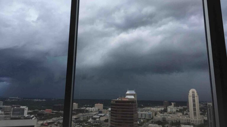
BATON ROUGE, LA — The latest HRRR high-resolution model is indicating that strong storms carrying damaging wind potential will push through the Gulf Coast corridor from Lake Charles and Baton Rouge through New Orleans, Gulfport, and into the Mobile area by approximately 8 AM tomorrow morning, raising significant concerns about an early morning severe weather arrival that could catch residents across Louisiana and Mississippi off guard during the overnight and early waking hours.
HRRR Model Flags Dangerous Early Morning Storm Window
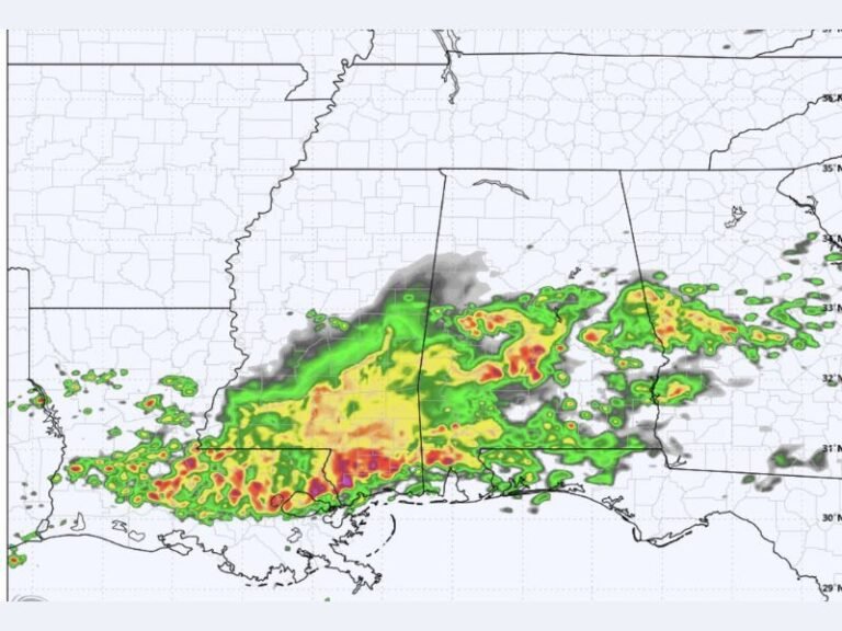
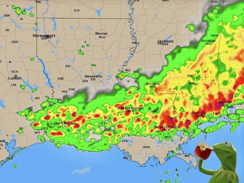
The High-Resolution Rapid Refresh model, one of the most reliable short-range forecasting tools available for near-term storm prediction, is depicting a well-organized and intense storm band pushing through the Gulf Coast region by 8 AM tomorrow.
The model imagery shows a broad swath of heavy precipitation with embedded intense cores stretching from the Lake Charles area eastward through Baton Rouge, across the New Orleans metropolitan area, and continuing through coastal Mississippi toward Gulfport and the Mobile corridor.
The early morning timing of this storm system represents one of its most dangerous characteristics, as residents across the region may be asleep when the strongest storms arrive, leaving little time to respond to warnings without active alert systems in place.
Damaging Wind Potential the Primary Threat
The dominant hazard identified with tomorrow morning’s storm system is damaging wind potential embedded within the stronger cells pushing through the Gulf Coast corridor. Strong and organized storm systems arriving in the early morning hours are particularly capable of producing damaging straight-line winds as overnight atmospheric boundary layer conditions can sometimes enhance wind threat with fast-moving convective lines.
Communities from Lake Charles through Baton Rouge and New Orleans into Gulfport and Mobile all fall within the zone where damaging wind gusts could impact trees, utility infrastructure, and structures during the 8 AM storm window across the region.
Intense Storm Cores Visible Across Louisiana and Mississippi
Model imagery clearly depicts the most intense storm cores concentrated along and near the Gulf Coast from southeastern Louisiana through coastal Mississippi, with the heaviest precipitation returns shown in deep red across the New Orleans, McComb, and Gulfport zones.
The broad geographic coverage of the storm system means that multiple major Gulf Coast population centers will be impacted in relatively quick succession as the line advances eastward through the morning hours.
Shreveport and Alexandria in northern Louisiana show lighter and more isolated activity on the model, indicating the most significant threat is concentrated specifically across the southern tier of both states.
Residents Must Have Alert Systems Active Tonight
Given the early morning arrival time of the most dangerous storm activity, residents across the entire Gulf Coast corridor from Lake Charles to Mobile are strongly urged to ensure all weather alert systems, including wireless emergency alerts on mobile devices and weather radios, are fully active before going to sleep tonight. Early morning severe weather events without active alert systems in place represent one of the most preventable yet persistent causes of weather-related injury across the Gulf South region.
For continuing coverage of severe weather events and critical storm analysis across the United States, visit SaludaStandard-Sentinel.com.