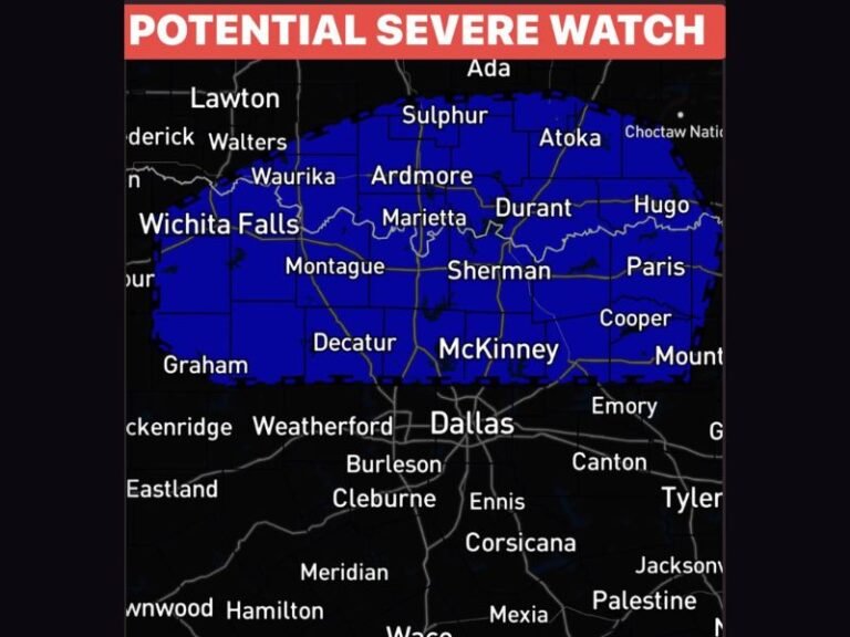
Severe Storms Tornadoes Flash Flooding and Near 100 Degree Heat Index Threatening the Illinois Wisconsin Stateline Wednesday With Widespread Gusty Winds
ROCKFORD, IL — A potentially wild and dangerous Wednesday is unfolding across the Illinois-Wisconsin Stateline on June 10, with heat index values approaching 100°F fueling explosive storm potential through the afternoon and a more widespread and severe storm round expected between 6 p.m. and 1 a.m. bringing gusty winds, isolated tornadoes, hail, and flash flooding concerns through the overnight hours.
The Heat and Humidity Setup
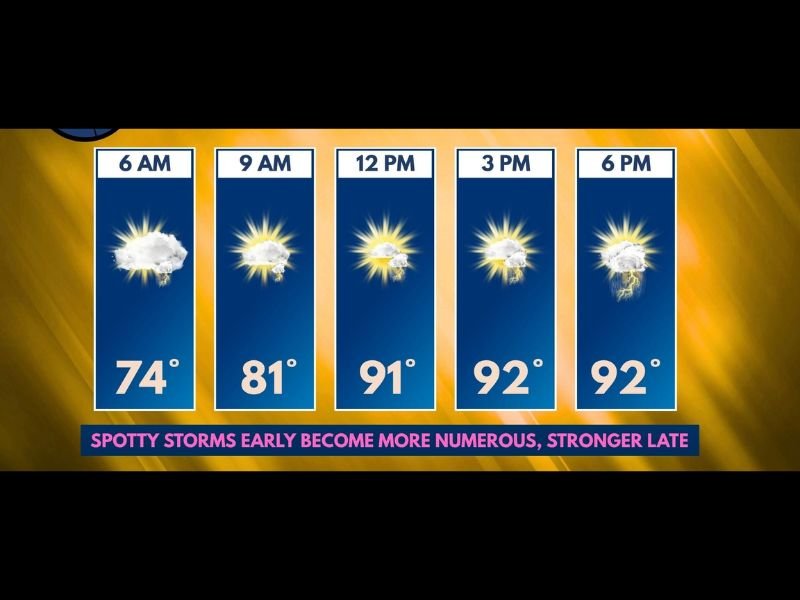
Temperatures will surge into the lower 90s through the afternoon, peaking at 92°F by 3 p.m. and holding there through 6 p.m. The combination of that heat with an astronomically high moisture content in the atmosphere will push heat index values to flirt with or reach 100°F during the peak afternoon hours — a level that creates dangerous conditions for anyone spending extended time outdoors and simultaneously provides enormous fuel for thunderstorm development.
The day begins at 74°F at 6 a.m. before climbing to 81°F by 9 a.m. and reaching 91°F by noon as sun angle and surface heating accelerate through the morning.
Afternoon Storm Window
Morning storms will be spotty and generally non-severe, with brief downpours and wind gusts possible but overall concern remaining low. The afternoon picture depends heavily on cloud cover — more sunshine means greater surface heating, more instability, and a higher chance of explosive severe storm development. If sufficient sun reaches the surface through the afternoon, storms could rapidly intensify with all modes of severe weather potentially in play including tornadoes, large hail, and damaging winds.
Evening and Overnight Severe Round
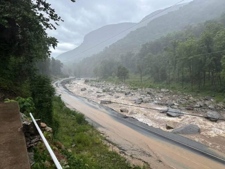
The more significant and widespread storm threat arrives between 6 p.m. and 1 a.m. as a more organized system pushes through the region. Widespread gusty winds represent the primary hazard for this round, with isolated tornadoes and hail also possible. Flash flooding is an additional concern given the extraordinary moisture levels already in place across the Stateline, as training storms could deposit heavy rainfall totals over the same areas in a short period.
How to Stay Safe Wednesday
Residents should complete all outdoor activities before early afternoon and keep weather alerts active through the entire overnight period. Do not assume the threat has passed after evening storms — the window extends well past midnight.
For continuing coverage of Wednesday’s severe weather threat across the Stateline and the United States, visit SaludaStandard-Sentinel.com.