Rhode Island Blizzard Pounds Providence as Snow Nears 3 Feet and Buffalo, New York–Level 40-Inch Totals Loom
PROVIDENCE, RHODE ISLAND — The powerful coastal blizzard still dumping snow across Providence and surrounding communities is showing no signs of ending quickly, with reports indicating the area checked in at around 3 feet of snow and snowfall totals potentially pushing toward the 40-inch mark before the system finally pulls away.
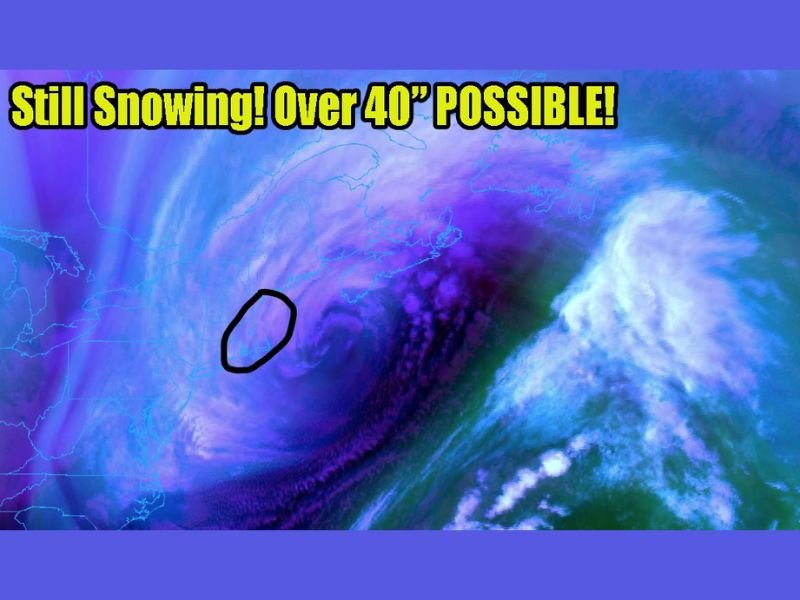
Forecasters and storm watchers say the storm remains a “behemoth” spinning off the East Coast, and satellite-style imagery shows a tightly wound circulation that continues to feed bands of snow back into southern New England. With snow still falling, even a few more hours of steady accumulation could turn an already historic event into a once-in-a-generation benchmark for parts of Rhode Island.
Providence Area Still Seeing Heavy Snow With Extreme Totals Possible
The latest updates suggest Providence and nearby towns are still in active snowfall, with totals already deep enough to bury vehicles and block neighborhood streets. The concern now is that continued banding could add enough additional snow to push the storm into the “over 40 inches possible” category for the hardest-hit pockets.
That kind of number would move beyond routine “big storm” territory and into the range where roof loading, blocked emergency access, and prolonged cleanup become major challenges—especially if winds continue to whip snow into drifts and reduce visibility on major roadways.
Why This Storm Isn’t Letting Go Yet
Storm imagery shows the system continuing to spiral offshore, which can keep snow bands rotating inland even after the worst of the coastal low appears to be moving away. When those bands repeatedly set up over the same corridor, totals can jump rapidly—sometimes by several inches in a short stretch—making it difficult for plows and road crews to keep up.
The Buffalo Comparison: What It Means for the Northeast
Observers compared this to Buffalo, New York–type snowfall, a reference used when totals start approaching the kind of deep, disruptive accumulation that overwhelms transportation and daily life. While every storm is different, the comparison signals the seriousness of what some neighborhoods may be facing if snowfall rates remain steady.
What Residents Should Do While Snow Continues
If snow is still coming down where you are, plan for limited travel, keep exits and vents clear when safe, and prepare for a long dig-out. Conditions can change quickly under intense snow bands, and the difference between “major” and “historic” can be just a few more hours of steady accumulation.
What are you seeing in your area right now—heavy snow, drifting, or improving roads? Share your local conditions and follow the latest updates at SaludaStandard-Sentinel.com.