Potential Storm One Targeting Louisiana Mississippi and Alabama Tonight With Significant Flooding and 40 to 60 MPH Tropical Force Wind Gusts
NEW ORLEANS, LA — Potential Storm One is organizing in the northwestern Gulf of Mexico Wednesday morning with a large burst of convection building offshore, and regardless of whether the system receives the name Arthur from the National Hurricane Center, dangerous and potentially flood-producing weather is heading toward Louisiana, Mississippi, and Alabama tonight with tropical storm force wind gusts of 40 to 60 mph and significant rainfall expected from the system’s eastern rain bands.
Current System Status
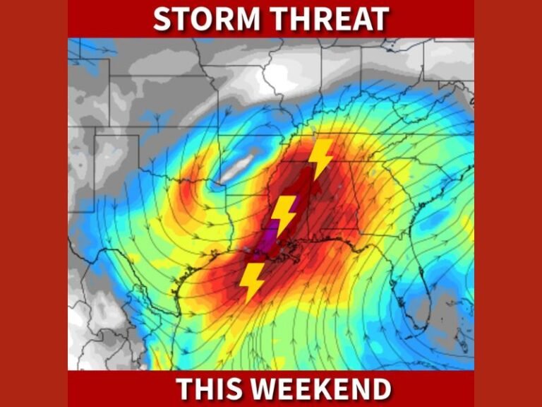
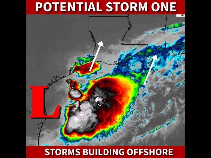
Satellite imagery shows a broad and active low pressure center positioned in the northwestern Gulf, with intense deep convective towers — depicted in deep red and white on the enhanced satellite image — wrapping around the circulation. The NHC has not yet designated the system as Tropical Storm Arthur, noting that the heaviest storm activity is displaced too far east of the center to meet formal naming criteria at this time.
Two white arrows on the satellite image indicate the primary rain band tracks moving northward toward the Louisiana coast and a secondary band pushing toward Mississippi and Alabama — confirming that significant tropical moisture is already being directed toward the Gulf Coast regardless of the system’s official classification status.
Flooding Is the Primary Concern
Forecasters express significant concern that somebody along the Louisiana, Mississippi, and Alabama coast will see major flooding tonight as the system’s heaviest rain bands push onshore. The eastern portion of the circulation — historically the most active and rainfall-productive quadrant of Gulf systems — will be positioned over coastal Louisiana and extending into Mississippi and Alabama as the storm makes its approach tonight.
The combination of slow storm movement and tropical moisture levels capable of producing rainfall rates of several inches per hour creates conditions where localized flooding events can develop rapidly and reach catastrophic levels in low-lying coastal areas.
Wind Threat
Beyond flooding, tropical storm force wind gusts of 40 to 60 mph are expected within the heaviest rain bands east of the center. These winds are capable of downing trees, disrupting power, and creating hazardous driving conditions across the affected coastal zone through tonight.
Residents across coastal Louisiana, Mississippi, and Alabama should finalize all preparations immediately and avoid unnecessary travel after dark tonight.
For continuing coverage of this Gulf Coast tropical threat, visit SaludaStandard-Sentinel.com.