High Daily Storm Chances Continue Over Houston Texas With Rare Freeway Cloud Formation Observed Tuesday Morning as Afternoon Activity Peaks Through Midweek
HOUSTON, TX — Daily storm chances across the greater Houston metropolitan area will remain elevated through the next couple of days with afternoon hours representing the peak window for storm development, while an unusual and rare atmospheric phenomenon captured on Tuesday morning drew significant attention when clouds formed directly over the Houston region’s freeway network in a striking satellite image captured at 8:00 AM on June 2, 2026.
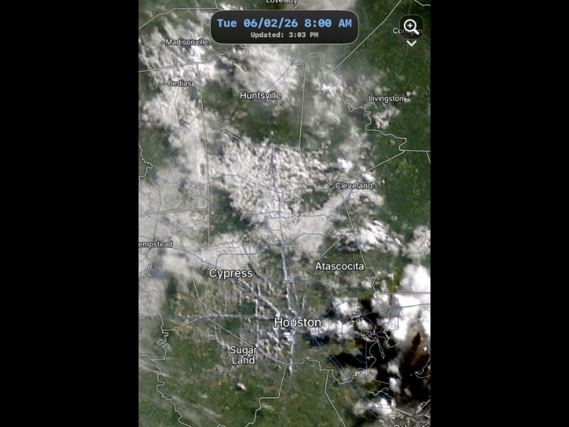
Rare Freeway Cloud Formation Captured on Satellite
Satellite imagery from Tuesday morning at 8:00 AM shows a visually remarkable and scientifically interesting cloud formation pattern across the Houston metropolitan area, with cloud development appearing to trace and follow the major freeway corridors cutting through the urban landscape in a pattern that drew immediate attention from meteorologists and weather observers monitoring the region.
This type of freeway-aligned cloud formation is a rare but documented phenomenon driven by the urban heat island effect, where the extensive concrete and asphalt surfaces of major highway corridors retain overnight heat more intensely than surrounding vegetated areas, creating localized zones of enhanced surface heating and moisture flux that can trigger or organize cloud development along the highway alignment during early morning hours under specific atmospheric conditions.
Daily Afternoon Storm Chances Persist
Beyond the unusual morning cloud event, Houston residents should expect continued high daily storm chances through the coming days with afternoon heating serving as the primary driver of convective development across the region during the peak moisture and instability period that defines early June weather across the Gulf Coast.
Satellite imagery shows an active and moisture-rich atmosphere already in place across the Houston area with cloud development evident across communities including Cypress, Huntsville, Atascocita, and the Sugar Land corridor during the Tuesday morning timeframe, reflecting the atmospheric instability and abundant moisture that will continue supporting afternoon and evening storm development through the midweek period.
Communities Across the Metro Area in the Storm Window
The broad coverage of cloud activity visible across the satellite imagery encompasses a wide swath of the Houston metropolitan region including communities from Madisonville and Huntsville in the north through Cleveland and Livingston to the northeast, Atascocita and Cypress across the middle metro band, and the core Houston urban area extending southward through Sugar Land.
This widespread atmospheric moisture coverage means that afternoon storm development could impact virtually any portion of the greater Houston metropolitan area during the peak convective window on any given day through the remainder of the week.
For continuing coverage of Houston weather developments and Gulf Coast storm activity across the United States, visit SaludaStandard-Sentinel.com.