Colliding Fronts Triggering Unpredictable Thunderstorms Across New England Friday With a Slight Risk Zone Covering the Northeast Coastal Corridor
BOSTON, MA — An unsettled and meteorologically complex Friday is underway across New England and the broader Northeast on June 12, with colliding frontal boundaries, heat, and humidity combining to produce scattered showers and pop-up thunderstorms throughout the day in a pattern that forecasters acknowledge is exceptionally difficult to predict with precision given the disconnect between current radar returns and forecast model output.
Why Forecasting Is Difficult Today
The key challenge with Friday’s storm potential across the Northeast is the collision of multiple frontal boundaries interacting with surface heat and humidity in ways that are not fully captured by forecast modeling. When colliding fronts, heat, and humidity converge simultaneously, all the atmospheric ingredients for thunderstorm development are present — but the exact timing and location of storm initiation remains highly unpredictable.
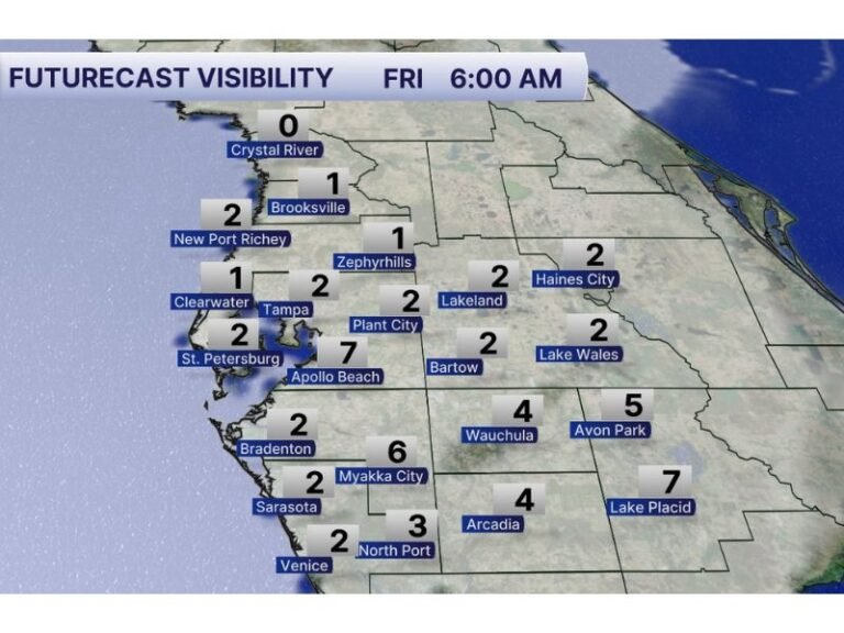
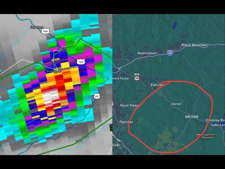
Current radar Friday morning showed scattered light returns across Vermont, New Hampshire, and into Maine, with active cells depicted near the Quebec border and across the central New England corridor — yet these returns were not aligning cleanly with what forecast models were showing, highlighting the inherent uncertainty in the day’s setup.
SPC Outlook and Risk Zones
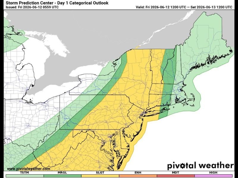
The SPC Day 1 categorical outlook valid Friday June 12 through Saturday morning depicts a slight risk zone covering portions of the coastal Northeast corridor, with a broader marginal risk encompassing much of New England and the mid-Atlantic region. The slight risk zone along the immediate coast reflects the highest probability of organized convection capable of producing small hail or gusty winds within stronger cells during the afternoon and evening hours.
A slight shift in the frontal boundaries later in the day could create a more favorable setup for quick-developing thunderstorms across portions of the region as afternoon heating peaks.
Weekend Outlook
Saturday currently carries no significant severe storm risk across the region, offering a cleaner and more enjoyable day following Friday’s unsettled pattern. Sunday brings an increase in scattered storm activity, though the severe weather threat remains low for that day as well.
Residents with outdoor plans Friday afternoon across New England and the coastal Northeast should remain flexible and keep weather alerts active as storm development timing remains highly uncertain through the day. For continuing coverage of Northeast weather and storm threats across the United States, visit SaludaStandard-Sentinel.com.